Sandy's Written Creations
Writings by Sandra Harrison including poetry, essays, fiction, non-fiction; children's literatire.
Blame Game
Shift the Blame:
When it comes to solving problems
It seems that everyone just wants to blame someone else for them.
But this just gets nowhere.
It’s the Blame Game.
When we expect others to fix things.
But instead, if we start by looking for solutions within ourselves
Things just might change.
Try adjusting your own life to deal with problems
The only one that you can truly control is yourself
Protecting Yourself:
What can you do to protect yourself?
When prices went up all over the world,
Everyone including the “talking heads” in media and politicians blamed their governments.
But it takes time for the government to act and/or solve problems.
Is there something you can do in the meanwhile to protect yourself?
Look for ways that you can make a difference in your own life
Reduce your own economics by spending less and saving more.
Buy differently or hold off on getting that really expensive item.
Look for sales or wait for them when they normally happen seasonally.
Drive less; consolidate trips.
Clean out that messy car trunk and home where you might find things you bought but forgot about.
Shop around for the lower prices.
Dealing with Crime:
When crime went up, they blamed the leaders of our cities and guns.
But, what can you do?
Protect yourself when going about your day.
Watch your back; be aware of your surroundings.
Let people following you close behind walk past you
Lock your car when pumping gas
Take the key out of the ignition.
Stop leaving valuables in the car or where they can be seen
Carry less
Don’t carry all your credit cards and cash but just what you need that day
Keep your cell phone safely in a secure location instead of in your hand
Limit the times you walk alone at night or stick to the more lighted busier streets.
Lock your front door
Monitor calls and don’t answer those you don’t know the number.
Let the phone take a message instead.
Get working smoke detectors and make sure you put them in all the bedrooms.
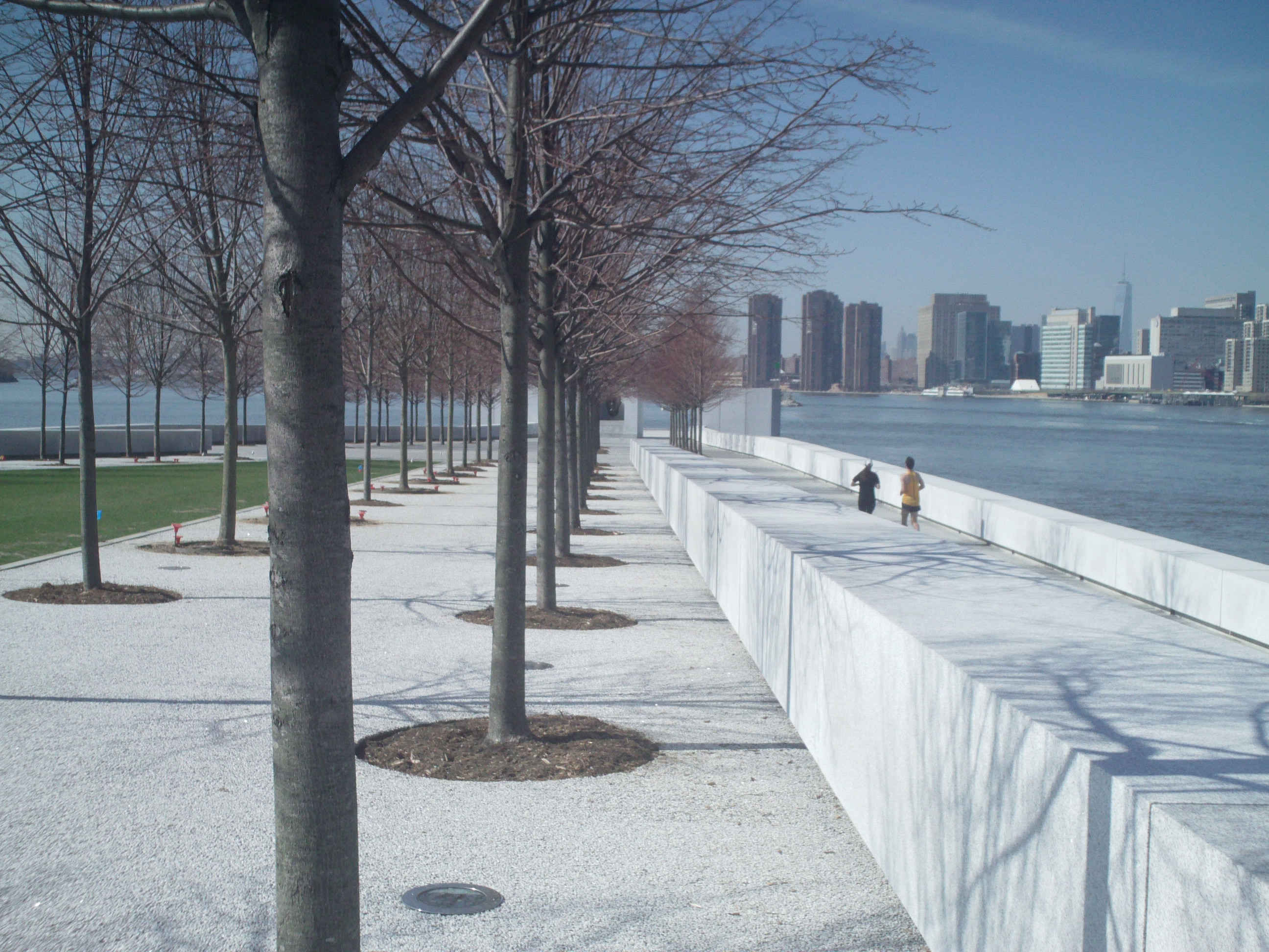
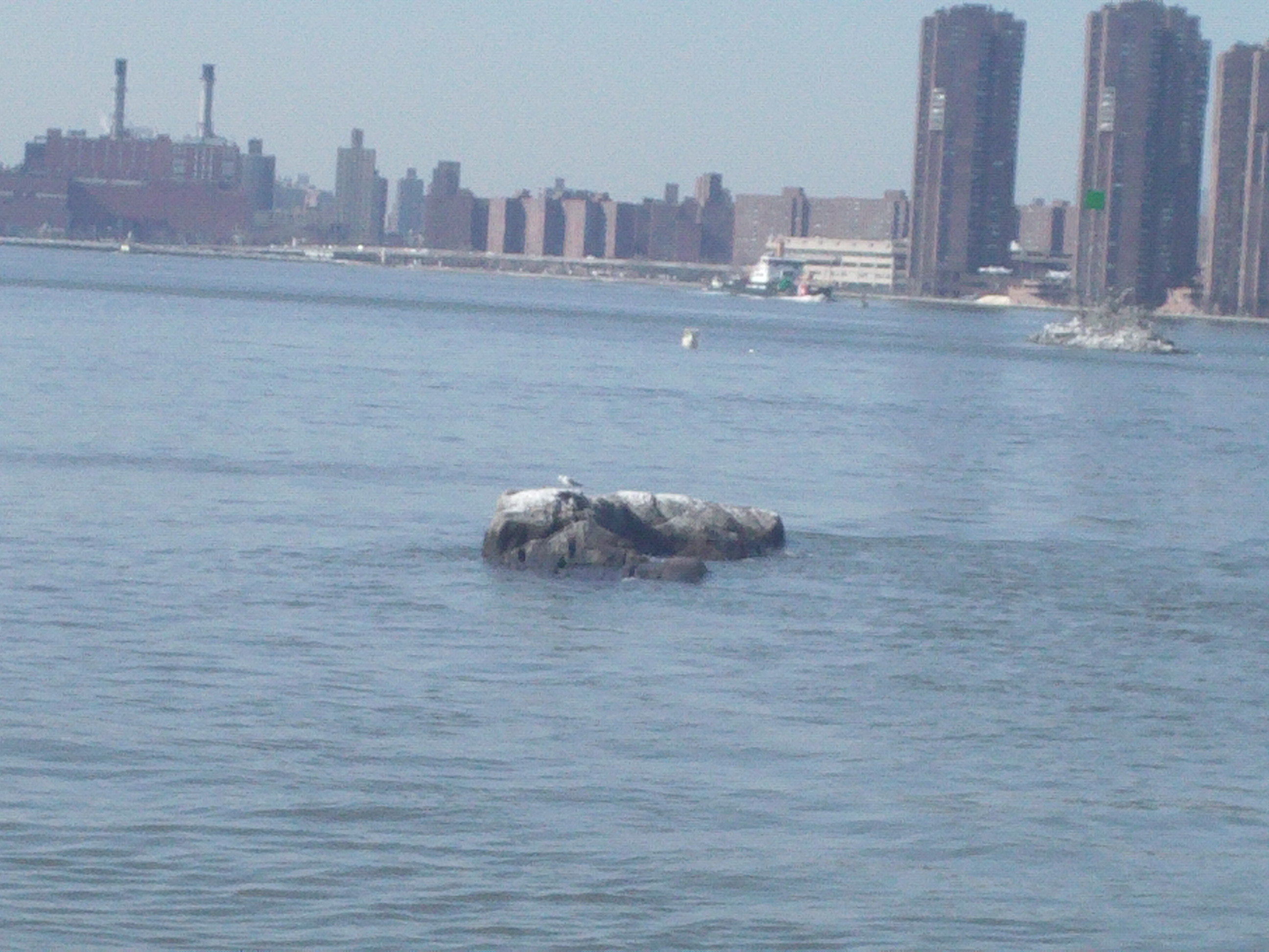
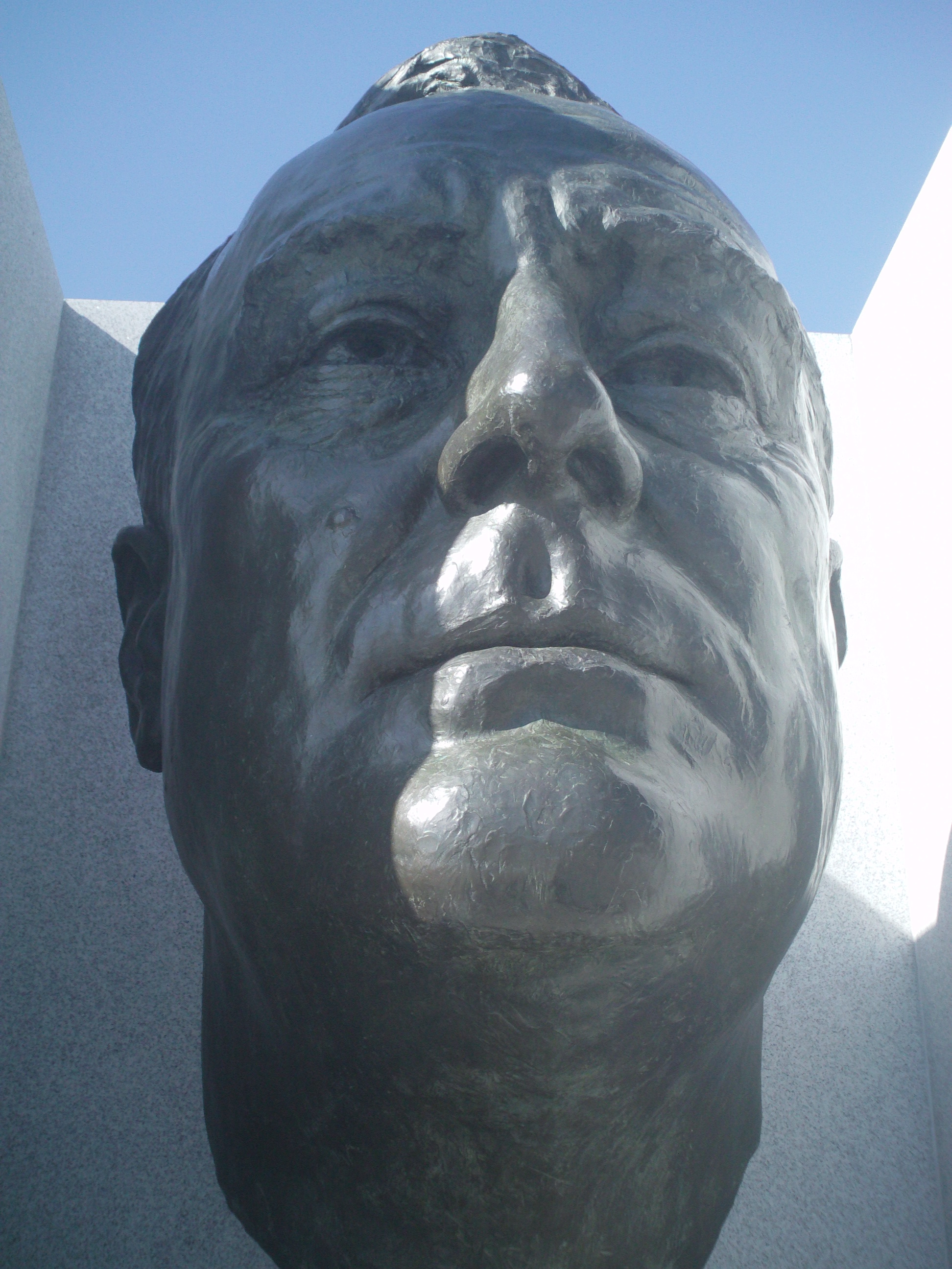
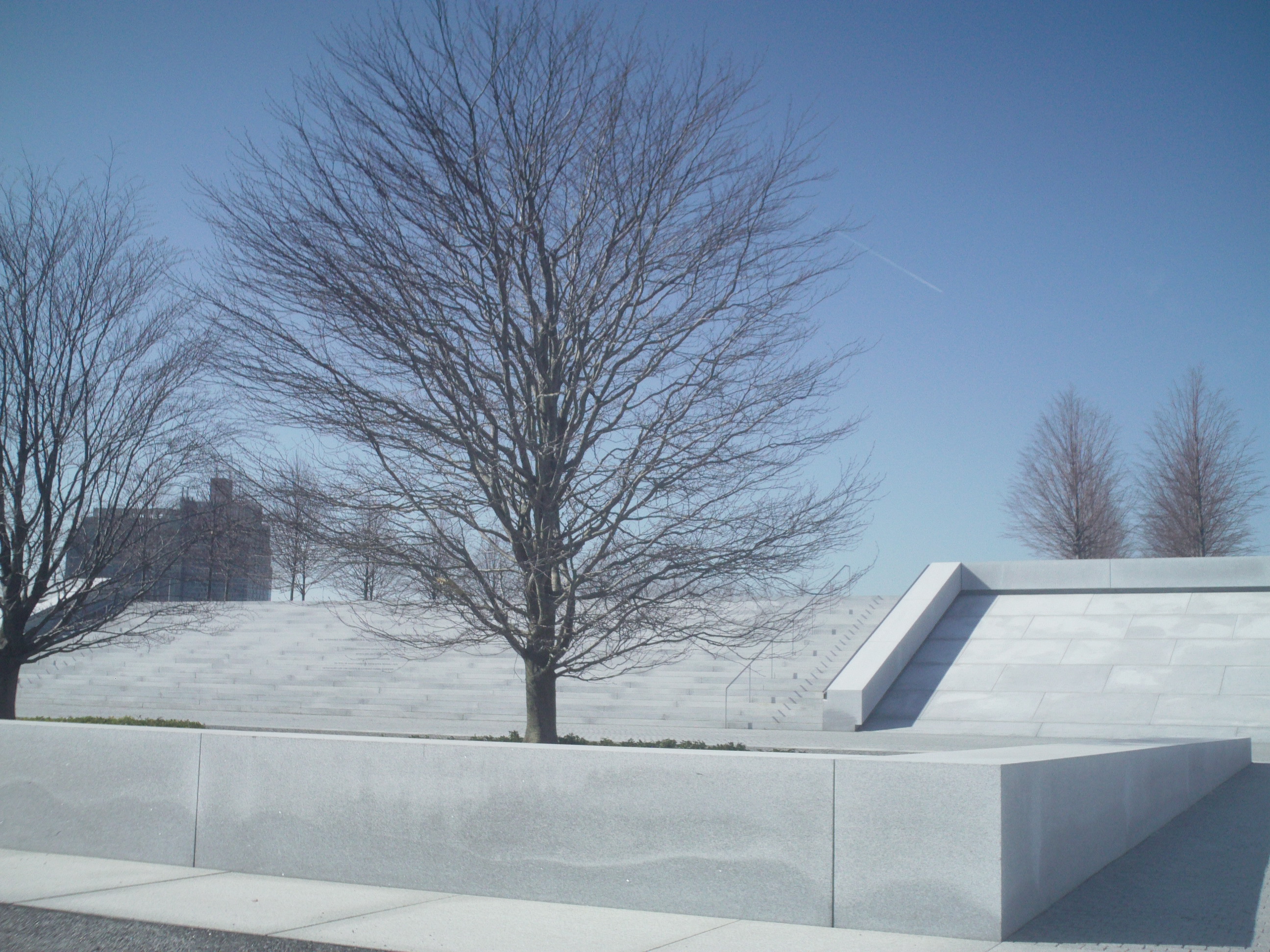
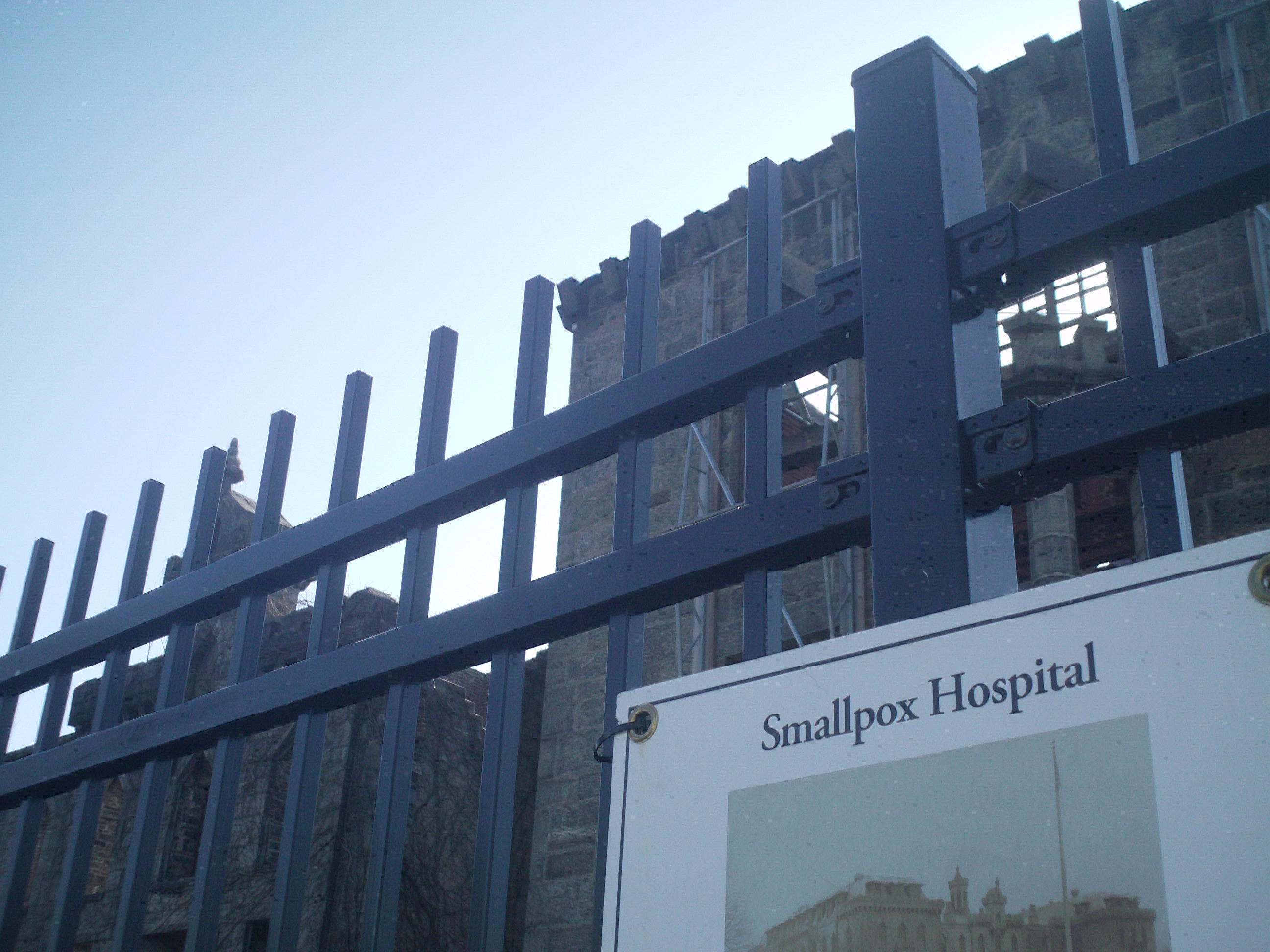
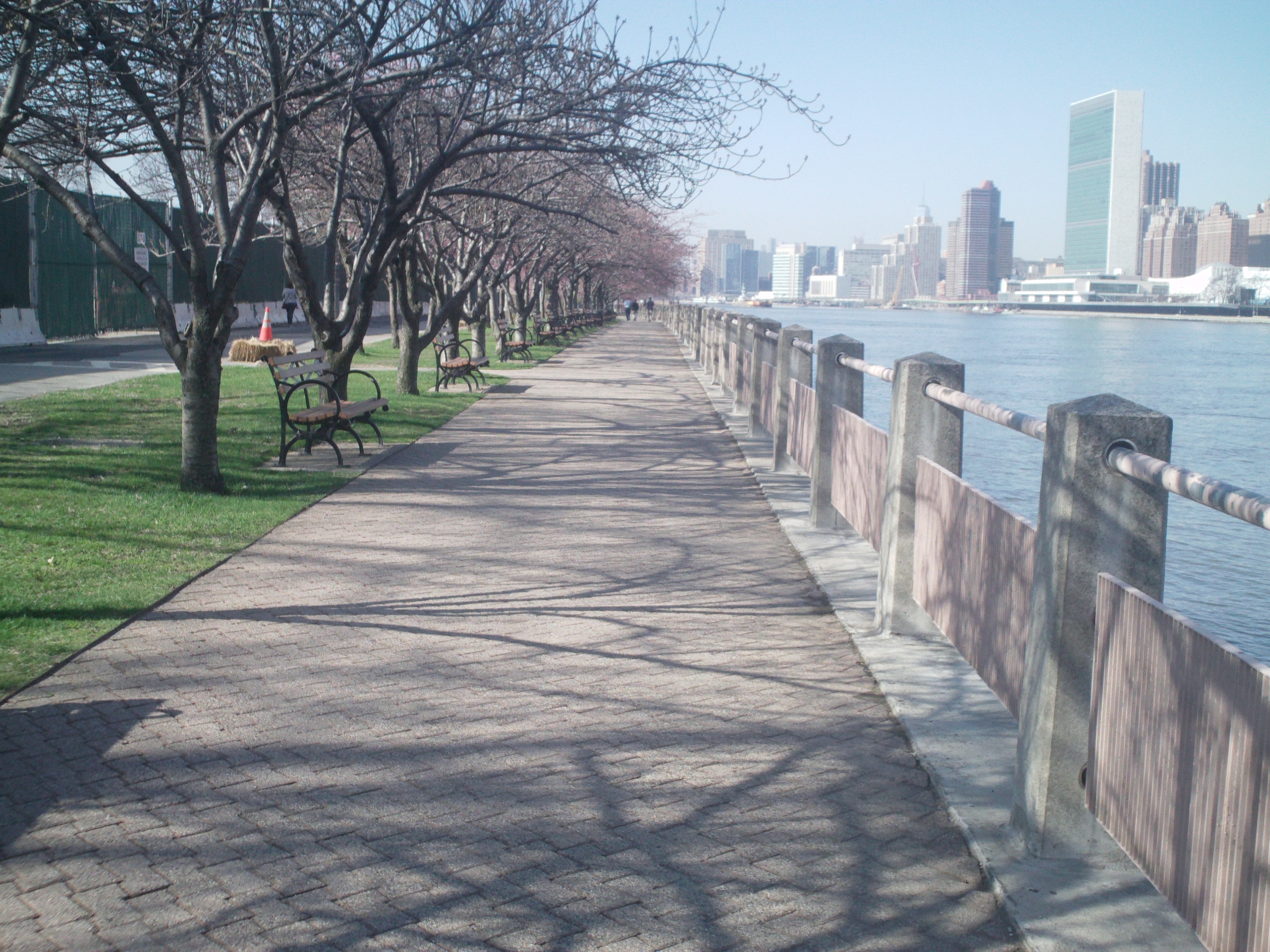
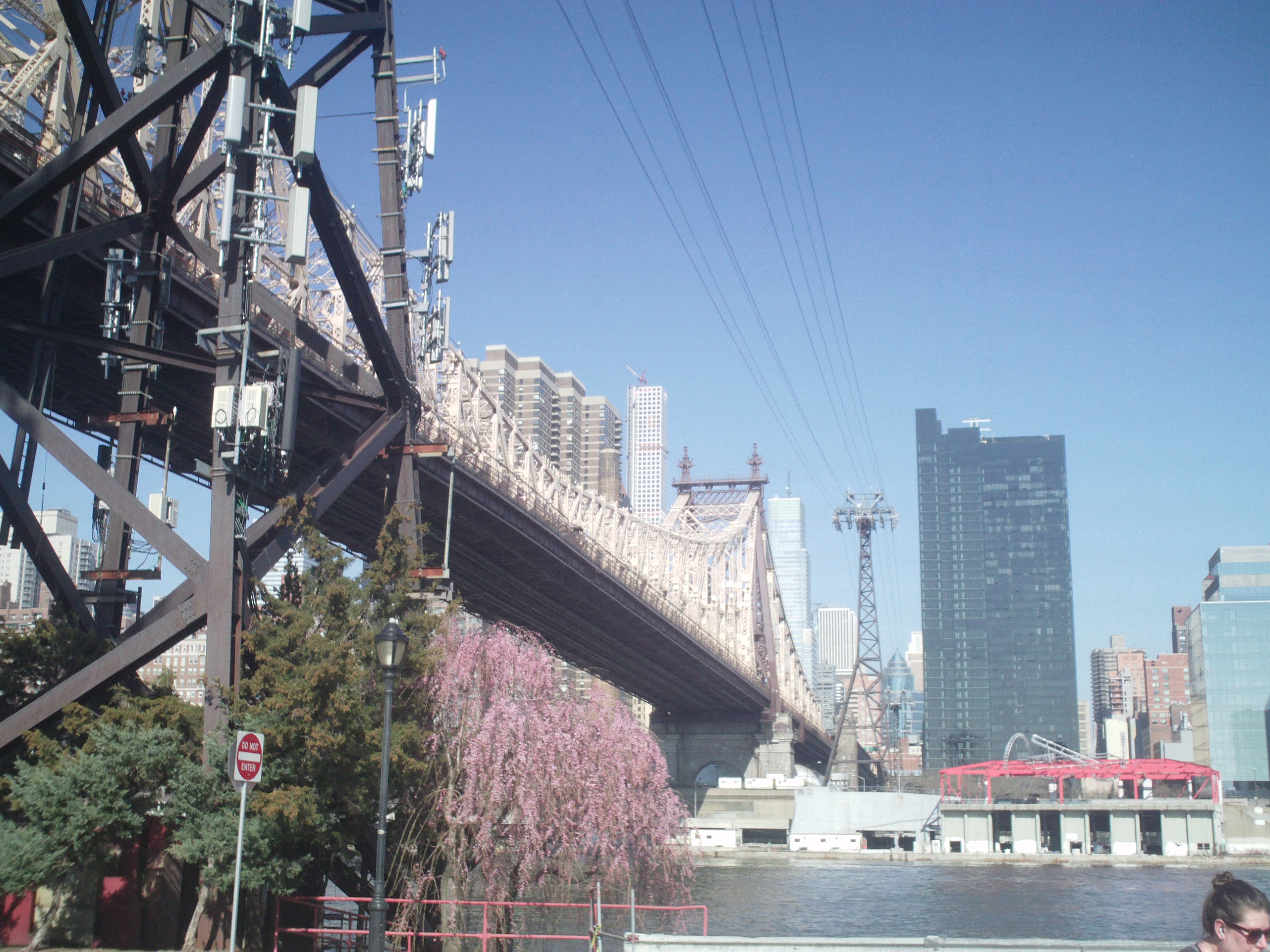
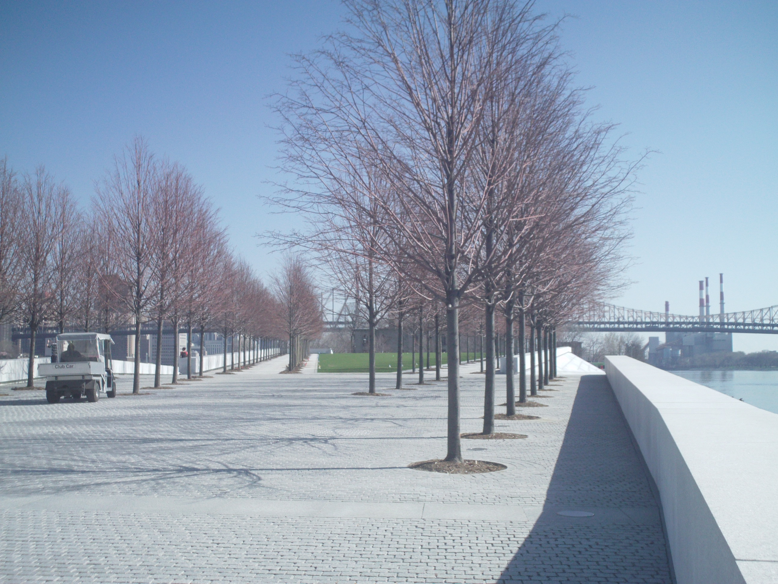
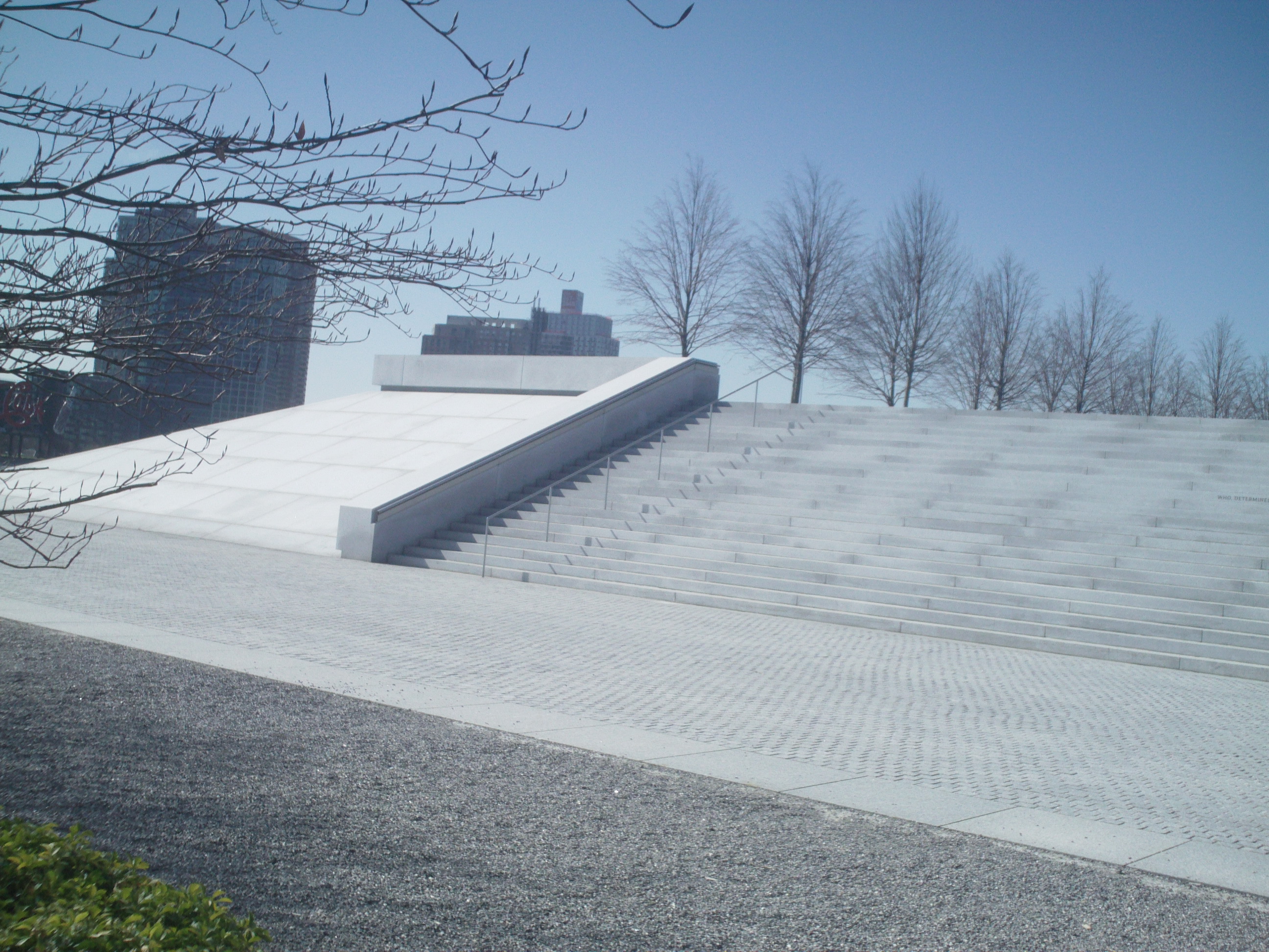
FDR Four Freedoms State Park
When this park opened, I decided to visit April 22, 2015, and these are my pictures:


I Know I am Getting Old When….
I know I am getting old when I can’t remember names of people I used to know really well.
I know I am getting old when I have to hire a Handyman to change those high above head light bulbs.
I know I am getting old when I can’t remember where I put things.
I know I am getting old when I need my land phone to find my mobile phone.
I know I am getting old when I can no longer cut my toenails.
I know I am getting old when I can no longer bend down to pick things up without pain
I know I am getting old when I have a fall.
I know I am getting old when I have trouble sitting on the floor and then getting up from it.
I know I am getting old when I need something to hold on to when I get in and out of a tub
I know I am getting old when cleaning becomes difficult.
I know I am getting old when I start having trouble opening my windows.
I know I am getting old when I can’t remember why I went into a room.
I know I am getting old when can’t read things without a magnifier. Luckily my cell phone has one.
I know I am getting old when I can’t open jars like I once did.
I know I am getting old when I am too tired to be tired.
I know I am getting old when I can’t get on a ladder or even a step stool without difficulty.
I know I am getting old when the face in the mirror looks tired, wrinkly and just plain old.
I know I am getting old when I now qualify for senior discounts.
I know I am getting old when I qualified for SS and Medicare.
I know I am getting old when I want to get rid of my collections.
I Know I am getting old when I can’t remember what I was talking about while talking to someone
Will Never Surrender to a False God
Will never surrender to a false god,
Even if it means being alone.
Never was a follower,
Made my own path in my journey of life.
It can be lonely sometimes.
Then give my soul to a false god.
Never will be a sheep,
Blindly following the herd.
I will then forge forward with my eyes wide open,
Even as I lose my sight.
Want to make up my own mind,
Live my own true self,
To be truly free.
Standing on top of the mountain,
Or on top of a building.
Looking down at what is the glorious Earth.
Letting in the sunshine,
Exposing every bit of me,
Letting out my fears.
Time to break out of my isolated pandemic life.
And get back to the things I once enjoyed.
Scared, yes.
But it is time.
How about you?
Objection to White Plains re Development of 70 Westchester Ave.
This is the letter I emailed the City’s Mayor, Common Council and City Clerk:
I would appreciate you reading and putting in the record my objection to the development for 70 Westchester Ave and the subject of tonight’s public hearing:
I strongly object to the project proposed for 70 Westchester Ave as I was with The Collection (and that project also seems to have stalled).
I know it really doesn’t matter what I think and unlike most of my neighbors I have spoken up and reported issues to the City. Most people have given up because they believe the City will do what it wants to do regardless of what its residents want. City, property owners and developers make money so it just doesn’t matter anymore what the residents affected by these developments think or what they will have to put up with not only during construction but after construction. Our quality of life in this neighborhood has diminished for decades as a result of overdevelopment and will continue to be a problem for those that live here.
For the sake of the hundreds who live on Franklin and thousands that live in the Eastview neighborhood, please reconsider and require the developers make changes to the present plan.
The buildings planned for Franklin are too high and take up too much of the properties space. They will over power the street’s other structures including mine that sits on the top of the hill. We will no longer see anything from our windows and the development will block our morning sun.
The remaining greenspace on the street will be in the shadows and could be affected by less sun. With the addition of more cars parking in the garages and going out of The Collections lot for residents there will be more noise/ traffic/air pollution. There will be the increased threat of flooding on Franklin and Amherst due to the construction of underground garages. There will be a big increase in the number of people living on the street and more pets that now do not have enough spaces to be toileted and walked. Many people are not picking up after their dogs, toilet their dogs on others property (on the grass and onto plantings), and sometimes are walked without leashes and ones that expand to more than 8 ft. These pets are being brought into shops selling or serving food when this is illegal. Many of the buildings in the area are now no smoking and so the smokers use the sidewalks and few greenspace areas we have and the smoke goes up into the apartments.
We will have three multi-tier garages right near each other with 2 on Franklin in addition to one on top of Stop & Shop parking lot. This means more cars entering the street, more car alarms going off, bright lights all night long and more air/noise pollution. Building alarms at Stop & Shop go off all the time (with a loud noise and flashing lights) and endlessly unless someone calls the police. This is just too many garages in such a small condensed area.
Now, that Toll Brothers owns both areas being redeveloped, I am not sure why they do not modify the plan for The Collection so that there is only one exit/entrance to the properties with the light at Paulding. With a separate entrance for The Collection, this new Development will complicate the intersection at Paulding with vehicles including trucks wanting to go over to the left lane while others are waiting to go north. These vehicles will want to turn left at light or will make u turns to go the opposite direction.
By putting another tall building on Franklin Otherwise, you are creating a wind tunnel on Franklin. There needs to be setbacks for these building on Franklin just like the rest of the buildings already there otherwise you have changed the street design forever. I hope they can put the tall structure and garage away from Franklin and closer to Westchester Ave. I hope they put in new sidewalks and do not remove the mature trees growing along the road. Trees help harness the wind, absorb water and anchor the soil. And, Franklin is very windy. Will they be putting the telephone and electric lines underground as promised?
We don’t need more shops/restaurants especially empty ones and if the dealership stays it is going to continue creating issues for the area especially with the delivery and storage of hundreds of cars in the garages (above Stop & Shop, at The Westchester and every other parking lot in the City) and might even take up spaces in the garages planned for this development. Moving these cars all the time, is another contributing factor to noise, pollution and traffic.
More people will compete for the few parking spaces on Franklin. And there is little enforcement of the 2-hour limit and no parking overnight. Many people park on Franklin to avoid parking fees City Center area and The Westchester. The shops along The Westchester near Franklin do not have parking lots. There are now empty shops at The Westchester. We need a delivery area at the top of Franklin since that is where the deliveries are made. I have asked for this to change with the one at the bottom by Amherst but this was turned down twice. Deliver trucks often block traffic on Franklin and park on sidewalks on side where parking is not allowed. Cars/trucks often block entrances to driveways and even the crosswalk at top of street. Vehicles/stop often park on Westchester Ave in crosswalks and in the traffic lane.
Area is blighted due to the neglect of not just the present owners of the two properties who do not maintain or use the property without regard to those living in the near areas but by the other neighbors in the area that will be staying including the City. Those old buildings at Key Fords were falling apart for years and yet it took complaints from people like myself to see them leveled. The owners of the former Key Ford dealership do not maintain their sidewalk on Franklin and during the winter this was a difficult place to walk as it is not flat. I cleared an area of weeds and litter that was on the sidewalk during shut down where the entrance was on the street. So much dirt had accumulated there, that it was growing weeds. The property that had been a parking lot for Key Fords looked more like an overgrown forest full of litter, shopping carts storing the bottle collectors’ hoard.
These new developments will not erase urban blight but in fact they will just create more. As time goes on, the owners of the newest properties often neglect them and fail to maintain their sidewalks as required by the City. And, then the City fails to enforce its ordinances. These new developments will not be the Gateway into the City but the areas that are there now. They are not well maintained and weeds overgrown onto the sidewalks. There is the City building next to a gas station that has been under construction for like 5 years, the unmaintained Stop & Shop property with lots of carts, Hyundai dealership and Avis. The sidewalks here have been horrible for years and the area by Westchester Burger needs a redo.
Some of the bad neighbors in the area are The White Plains Coach Diner, Avis, Enterprise, Stop & Shop and now the building at 26 Franklin Ave. They have contributed to the decline of the neighborhood and are the reason for our urban blight, bad smells, pollution and noise. The wind carries dirt up the hill of Franklin and the areas between my window’s screens and the inside window is filled with dirt. The top of the garage for my building outside my window is filled with dirt and it settles in the drain and weeds are growing out of it.
White Plains Diner does not maintain its frontage area very well. There is a tree out front by Westchester Ave that is full of weeds overgrowing onto road. Litter is not cleaned up and goes into the storm drain they have at the entrance. During the pandemic they even strung a banner advertising beer along the street between two of the trees along the sidewalk. The Diner stinks up the neighborhood and this summer there has been an awful grease smell. And, because this diner is open 24/7, the smell is at all hours. Cars often make U turns from Westchester Ave going down the hill from Armory Place at the Paulding light and head north on Westchester Ave. Many are taxi drivers picking up passengers or letting ones out at Diner. Diner noise from garbage trucks at 5 am.
Enterprise does not maintain their frontage area and has a bush that over extends to the small sidewalk area. They do not always clear the sidewalk area and it becomes ice in colder months. They clean their cars with water and it freezes. The overgrown bush in front is filled with litter and is never cleaned or trimmed off sidewalk. During the pandemic I actually trimmed some of this bush because it was very difficult to go by on foot.
Stop & Shop property areas along Westchester Ave and S. Kensico are just horrible. They do not always clear the snow like after a big storm last year. There is litter and shopping carts all over the property and they are often taken off the property and left in the surrounding community. Many are left on sidewalks and in the streets. Pedestrian entrance to Stop & Shop should be redesigned. Most people cut through where the vehicles enter. The parking lot is filthy and the lot that was supposed to be for residents in Eastview is now not being used. Neither is the entrance for the upper lot on S Kensico but the walk sign there is still running and barriers there are an eye sore. The store posts signs on S. Kensico and they are not regulated or appealing. The litter and garbage left there attract vermin including rats, mice and feral pigeons.
Chrysler Dealer leaves entrance to service area open so there is often lots of noise. They have a very loud machine going all day and night that is very disturbing at night. They decided to have a party Sept 21 with a loud music and a strove light that started earlier at 3:30 pm blasting so loud that noise vibrated off my building. Often cars are delivered in early mornings and too many cars are stored at Stop & Shop and the mall that need to be transferred to dealership all the time. Too many people make u turns on Franklin and area should be shut to truck traffic except for those having business on street.
Avis doesn’t clean up its green space and there is a lot of litter there by sidewalk. I cleared a shopping cart during the shutdown that was there for years. Cars/trucks coming out of Avis and Westchester Burger sometimes cross into the intersection of Bloomingdale Rd and Westchester Ave causing confusion for cars turning left from Bloomingdales on to Westchester Ave.
Pet store (Doggies City) at 30 Westchester Ave near Franklin has fencing that goes right to sidewalk, has a filthy yard often with feces and its plants go onto the sidewalk. The area is usually not cleared of litter and the pet owners allow their pets in yard barking at cars and people walking by. This noise is very disturbing and can be heard more than 50 ft away.
The storm drains on Franklin, Amherst and Windsor Terrace in street are often filled with litter. This area accumulates water/ice and during IDA parts of the street on Amherst got ruined with chunks are either at the drain or have gone in. If this area continues to flood and gets worse, the fields for Eastview will be at risk for flooding. Because of the lack of parking enforcement on the street the street has been filthy with the same litter there for weeks and washing down to the storm drains during heavy downpours.
Carts often accumulate at the Franklin Lot and they are often filled with litter and garbage. Litter ends up in the school playing fields. Pollution has blackened the parking lot overhanging the school’s field. Franklin Parking Lot is used by not just residents but Youth Bureau. It has many cars parking there that are not even permitted. A person is feeding a feral cat near the falling down fence for Westchester Burger. The sidewalk is not well maintained and needs replacing.
Twenty-six Franklin Ave has become a hazard and a noise problem for the neighborhood. They often use a blower in the evening and other gardening equipment after 6pm and into the evening after 7pm. The building dates from around 1924 and the back stairwell is being used as a terrace. Too many things are being stored there that should not be and a dog is allowed to be on the stairs barking all the time very loudly. There is smoking and tenants were barbequing under the covered stairs this summer. They now have more cars in their lot and moved their garbage to the other side of the building and there is a lot of things there like a mattress and one car on Oct 2 was on the sidewalk during the night. There is a young man living there who has two dirt bikes now taking them for runs doing wheelies in the middle of Franklin’s hill but also in my building’s parking lot. The person does not wear a helmet. The noise is terrible and dirt bikes are not allowed on the street or in my building’s lot. I think they are parking a van for a business in the lot. The overgrowth from the trees/vines at the property border with the dealership is growing on the telephone lines. The front yard is not well maintained either and there is overgrowth on to the sidewalk.
We need a light at Franklin and Westchester Ave not just to allow pedestrians to cross but to allow traffic from Armory Place to come in Westchester Ave safely and be able to go into Franklin Ave At times with traffic backed up it is impossible to get from Armory Pl to Franklin and even get out of Franklin to go north on Westchester Av. With the increase of people living on Westchester Ave there is going to be the need for a safer crossing. It would also be nice to put back a crossing area from Tibbits across Armory place to where The Westchester is. Many cross here anyways.
Parking should be brought back to areas along Westchester Ave where the City has greenspace so Franklin does not bear the burden of cars parking for shops on Westchester Ave but also for people going to City Center area, S Broadway and even the Westchester. This area could then be used by cars breaking down on the busy Westchester Ave and for City trucks to park for maintenance of the area across from Tibbits that is not designated park land. Area is used by dog owners and now smokers since many of the apartments have now gone smokeless.
Apartments on Franklin have set backs from the street and these two projects will not be so they will be right up to the sidewalks. I hope they will fix the sidewalks without taking out the mature trees and at least maintain them by clearing litter, garbage, carts and snow. This is not the case now on any consistent basis. Sidewalk for the City lot should also be redone. City does not do a good job of maintaining this property as well with green overgrowth and removing the shopping carts.
Flooding has become an issue as the City redevelops large lots. My building has flooding in the lobby since the City Center went in. Water goes downhill and goes to the lowest areas and ones that are vulnerable to flooding. Underground garages are vulnerable and the lowest area on Franklin is with Amherst though there are 4 drains there. Because the street is not cleaned properly litter from the street goes into the drains. Amherst was damaged near the intersection with Franklin during Ida and pieces of the street are scattered in the road and by one drain. Clearing the drains on street level is not the only areas that need clearing but below where the water goes into pipes.
The Collection and the addition of this project for 70 Westchester that extends to Franklin is not only going to add to urban blight issues but change Eastview completely. Maybe that is the intention to block the view of the neighborhood that the City is ashamed of though it is the home to thousands of residents. Many businesses and apartments are maintained well but there are some bad ones that this development will not change. Rewarding property owners for their bad practices is just beyond me. The area is going to be like that on Martine that is across from the City Center Parking lot though the difference is the street there is much wider. The parking lot is still a parking lot and the areas by the sidewalk will just gather litter and become dog toilets. Pollution from the many cars will just travel elsewhere.
With all the planned development, City is not increasing its services (fire, police, public works). This puts everyone in City at danger from the increase in crime, mental illness, drug use, air, water and noise pollution, spread of pandemics, water pollution and flooding. No new parks or open space for the public has been planned and this only puts more stress on the community. Crowding more people into the same small areas is not healthy and there will be a decline in the quality of life for all its residents. Homeless, vagrants and bottle people are frequent.
Our roads are in horrible condition in many places because of the traffic and the lines for dividing streets and crosswalks are not painted often enough, so are fading or are completely wiped out.
Developers and Lawyers representing the owners might claim they have reached out to residents, but I was never informed or any of the neighbors I spoke to. Most of the apartments on Franklin are Cooperatives like mine and if the Property Management knew or Boards knew they are under no obligation to notify residents. My Board not only did not do this but ignored my request for information about the Brownfield application. City owns the senior apartment building at Windsor that borders Franklin and Amherst. Did the City notify those residents? I did ask one man who lives there that is blind and he did not know of the new plans for 70 Westchester. We DO NOT HAVE a neighborhood Association and Tenants Associations are Boards; do not represent tenants/residents or citizens. They run the buildings. Shops in the area might love the new developments because it might help bring in customers, but these owners do not live in this neighborhood.
Sandra Harrison
Can’t Remember
Can’t remember what my life was like before the pandemic,
Before my mother fell in her house,
Before I became her POA.
And, do all her finances.
It’s like my retirement came to an end.
And, now I work for my mother
But, instead of getting paid,
It’s costing me
Not just my time and money,
But,
My
Sanity.
Lugging incontinence supplies,
Buying her powder.
Figuring out ways to make her life easier,
And, my life better.
Pandemic made me more of a homebody,
Getting more deliveries
Avoiding people
Eating out
Shopping
Visiting Museums
Or, just hanging out on a park bench.
Drive more,
Walk less.
Truly, wish things were as they were before,
But, they never will.
I just know it.
Never going to get back those days,
Those months
Or years.
Its like being in the Twilight Zone
Or a Dean Knootz novel
Stuck like a broken record
In, an endless loop
Making me so tired
I just want to sleep
Till reality wakes me back again.

Divided
Our Country has always been divided
And, you might ask, “When did we ever get along?”
From USA’s early existence
Through its Revolutionary past
And, now with the most recent Jan 6 insurrection
Reasons might have been different
But none the less,
There were always things to be unhappy about.
Even without phones, TV or computers.
People just didn’t always get along,
With their governments,
Their neighbors,
Or even their families.
Many came to America for this very reason,
And, things just didn’t improve as the country expanded.
Its a wonder how we ever got together to fight a war,
Against the British Empire.
Articles of Confederation took years to sign
And, even after it was, there were problems.
Violence was often a part of the American experience
No surprise there, actually.
Now, we have Twitter; Facebook to divide us
With others just trying to stir things up
Guess nothing ever changes,
And. perhaps nothing ever will.
Protect yourself,
Your future.
And, it might be best to figure out a way through it
Without driving you nuts.
Mammoth Garage of White Plains
From: https://www.hemmings.com/stories/2010/04/08/was-the-privates-car-a-g-j-g
The Mammoth Garage is no longer and the building was demolished for The Mitchell construction on Mamaroneck Ave. This is the story by Daniel Strohl
“The private’s car and the Mammoth Garage
By Daniel Strohl on Apr 8th, 2010 at 8:02 am
/stories/2010/04/privateandviola_750.jpg)
In This Article: Category: Motorsports
When we presented the photo that Marianne DeAngelis of the New York Guard sent us of a mystery racing machine helmed by Private Lewis van Alstyne and his dog Viola, much of the speculation of the identity of the car circled around Fiat or, possibly, Thomas. Yet David Greenlees is very sure neither of those answers is correct; instead, he’s almost positive that the car in question is a G.J.G. More specifically, he believes it to be a one-off racing machine built by G.J.G., and – get this – he thinks it still exists. G.J.G., for those of you without access to a Standard Catalog, stands for George Jacob Grossman, designer of the vehicle, built in White Plains, New York.
Grossman appears to have come from a well-to-do family: His father owned a successful furniture manufacturing business, and the family bankrolled the innovative construction of the factory as well as the company itself with a combined capital of $10,000 (about $241,000 today). Starting in 1909, Grossman offered two basic lines, the 26hp Junior, riding on a 104-inch wheelbase, and the 42hp Senior, riding on a 121-inch wheelbase and bestowed with dashing names like Pirate, Scout, Comfort and Carryall. Some sources claim the G.J.G. was nothing more than an assembled car, built from European components, but the Senior was reportedly able to reach speeds of 65 MPH, causing some observers to claim the initials stood for “Go, Jesus, Go!” Grossman was involved in racing: He offered his garage as the headquarters for the Isotta Fraschini team in the Briarcliff Race of 1908, and he is known to have built at least one race car himself, using a 60hp Wisconsin T-head engine and Brown and Lipe transmission on a Pirate roadster chassis. After G.J.G. advertised it as capable of at least 70 MPH, Paul G. Thebaud of White Plains bought it and entered it in the 10-mile non-stock free-for-all race against three Mercers, a Maxwell and a Fiat in the October 1912 automobile, motorcycle and bicycle races at the White Plains fairgrounds; we so far have found no record of how well Thebaud performed in that race.
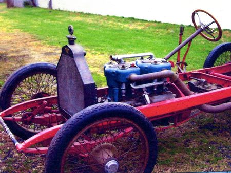
According to subsequent owners of the car, it at one point threw a rod through the crankcase, then was hit broadside, but repaired both times. At one point, it was owned by Frank Snook, then later by W.W. Bogardus, until he sold it to Tony LaPorta in 1955. LaPorta advertised it in Hemmings in 1991 (asking $70,000), but held on to it until 1995, when he sold it to Fred Hoch of Schaeffer and Long, the current owner of the car, who supplied us with much of this information and many of these photos.When exactly Lewis van Alstyne owned it, we don’t know. We do know that he was born in 1893 in Kinderhook, New York, served in World War I (which fits with his service in the New York Guard), attended the Massachusetts State College and became renowned for his landscape artistry before dying in 1951.
As for the G.J.G. factory, when the Grossman family opened it as the Mammoth Garage in 1908, not far from the intersection of Post Road and Mamaroneck Avenue, it garnered quite a bit of press for a couple reasons. One, it was allegedly the largest garage in the world, thanks to a new construction technique which involved concrete beams spanning the 80-foot width of the garage and which allowed for a completely pillarless floorplan (depth of the garage measured 250 feet). Two, the façade of the garage featured three tusked mammoth heads made of plaster, each two to three feet tall and fitted with orange light bulbs that glowed at night.
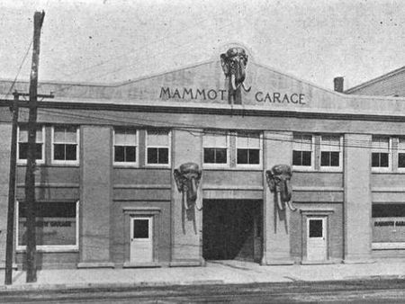
In 1913, Grossman found himself defending himself against a tire company’s lawsuit over the design of the car’s inverted triangle logo; while he won the lawsuit, he soon after told the press he intended to manufacture his cars elsewhere, but then sometime before the end of 1913 closed up shop for good.
According to Renoda Hoffman’s book on White Plains history, “Yesterday in White Plains: A Picture History of a Vanished Era,” the building later housed (sans the mammoth heads) the White Plains branch of the Uppercut Cadillac chain of dealerships, the largest Cadillac distributor on the East Coast. By the late 1930s, the building housed an Oldsmobile dealership. Hemmings Muscle Machines editor Terry McGean, who grew up in White Plains, said he recalls the building housing a drugstore when he grew up, a memory that Hoffman confirms, and today, its façade much altered, it appears to house a dollar store and a billiards hall.
Was the private’s car a G.J.G.? The shape of the radiator on the G.J.G. speedster seems slightly different, but is the closest shape we’ve seen to the shape of the radiator on the private’s car. The frame, however, appears to be a perfect match (see the four rivets?), as do the gas tank and shock absorbers. Plus, I’m not in the habit of doubting David Greenlees’s expertise in such matters.”
Climbing Towers and Crossing Bridges
Do you remember ever climbing to the top of a tower? I have done so many times but mostly when I was younger. I was less scared of heights back then. I have no trouble on top of mountains or cliffs cause they are naturally made. Do not trust man made towers or bridges as much.
Remember going up the Washington Monument in Washington DC where I believe we walked down after going up in elevator. Climbed the Statue of Liberty as a young child and then when in college. Climbed fire towers at Gettysburg with father and in some woods in Pound Ridge, NY.
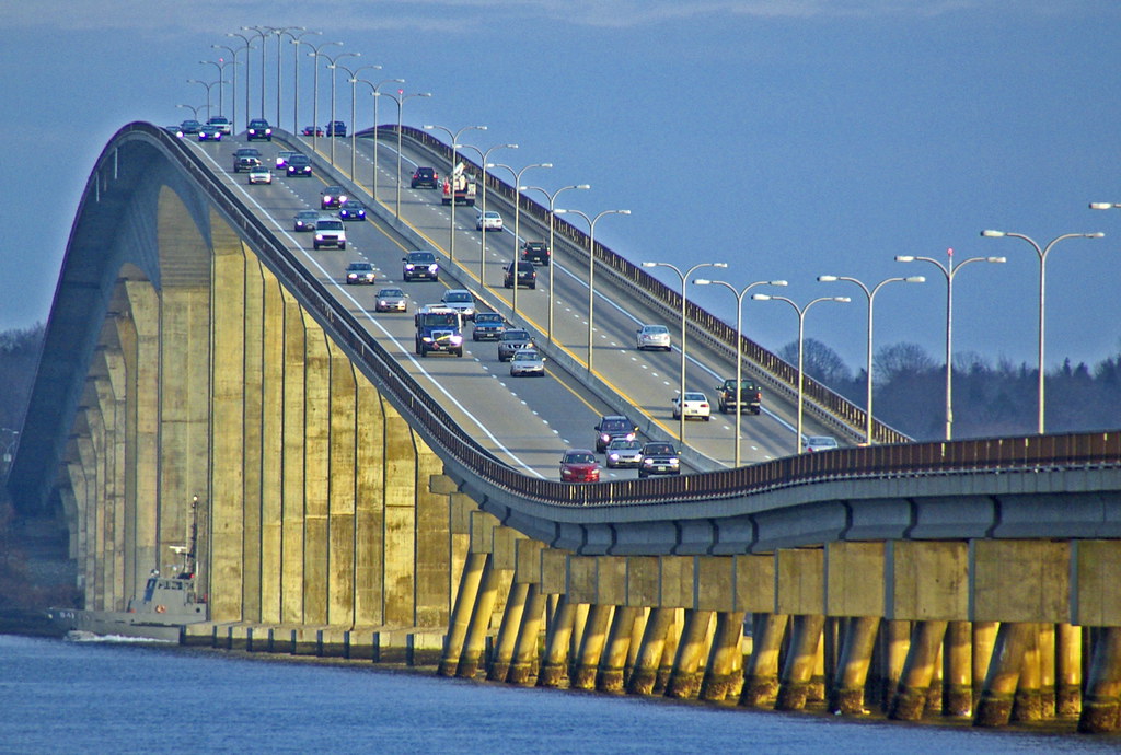
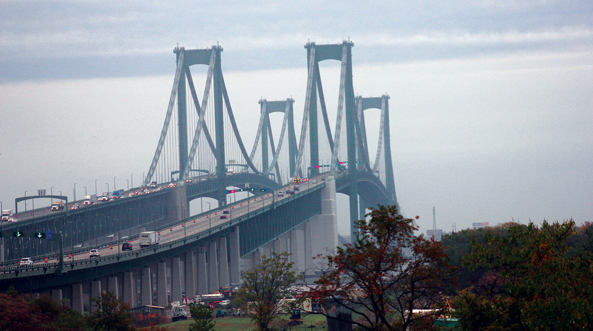
I remember going up Bunker Hill monument after doing the Freedom trail. It took me 20 min to cross the center of Charles River where the street opened to a metal see through grate. I was scared out of my life. Reminded me of Brooklyn Bridge where the rushing traffic made the old planks harder to cross (planks were replaced).
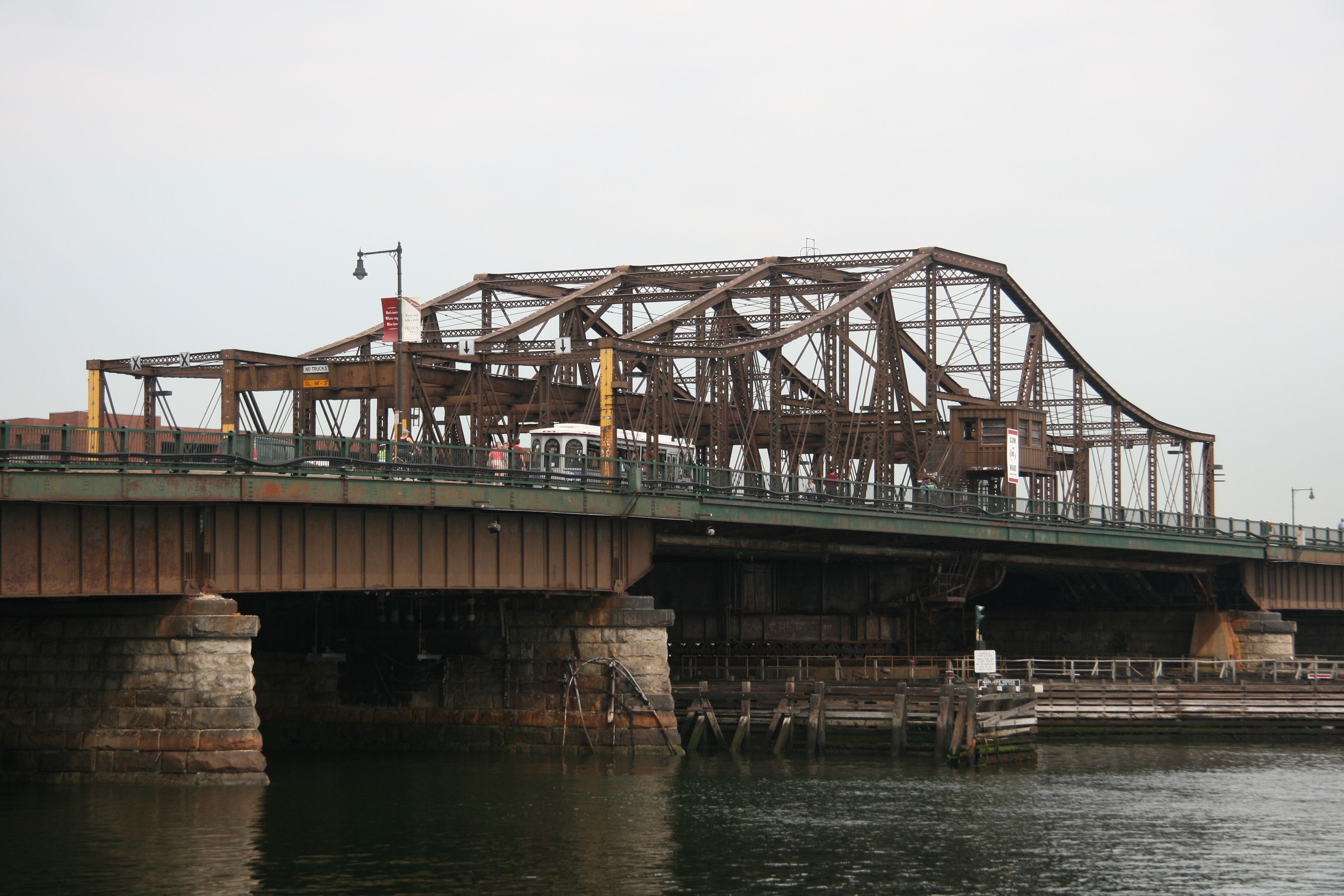

Bunker Hill, Boston
Walked across Hudson at Poughkeepsie and actually the cement paved former rail track was not scary at all. But once crossed an old rail track in the snow on a hike and I was scared out of my mind.
I have driven over bridges but when I was doing the driving, it was not such a great experience. Like over the Golden Gate, the former Tappan Zee bridge in NY in high winds and driving CJ Jeep and other bridge crossings for Hudson (Bear Mountain, Rip Van Winkle) but most scary ones were those going to Newport RI and once during a gale storm. I was like the only one on bridge driving into the wind and actually stopped and kissed the ground after getting over the 2nd. The winds were like over 40 mi an hour with pelting rain. It was worth the trip since Newport was a great place to visit

Crossed a lot of bridges in my trips to London and Paris. There are lots of them. Tower of London Bridge had a tower in the center area to climb or use the elevator to then cross on top. I even crossed that bridge with locks that fell into river in Paris so they had to remove the locks.

Travelled south on 95 a number of times and lots of bridges to cross on the way south to Virginia, Georgia, Asheville NC, South Carolina, Savanah, Charleston, Outer Banks, and many others. Lots of bridges to and from and on Long Island.
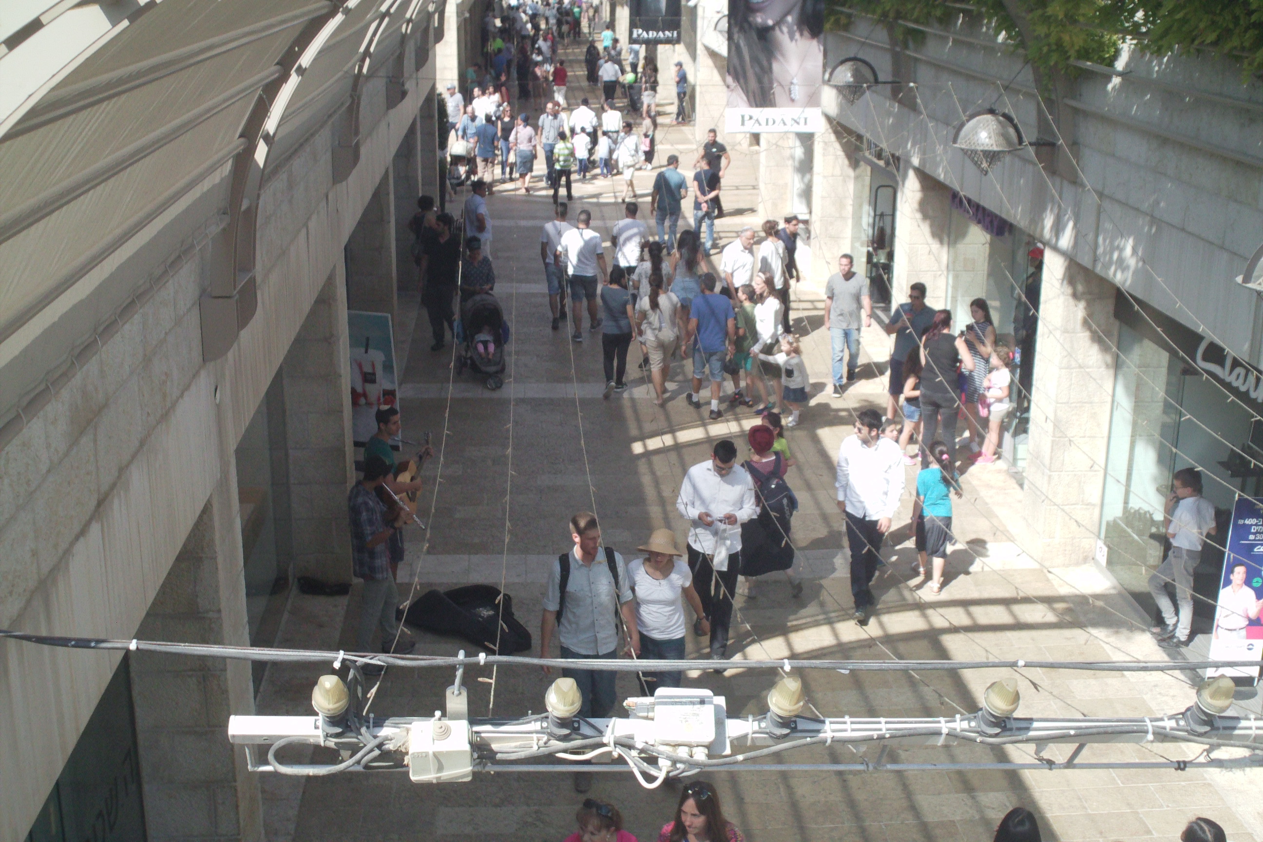
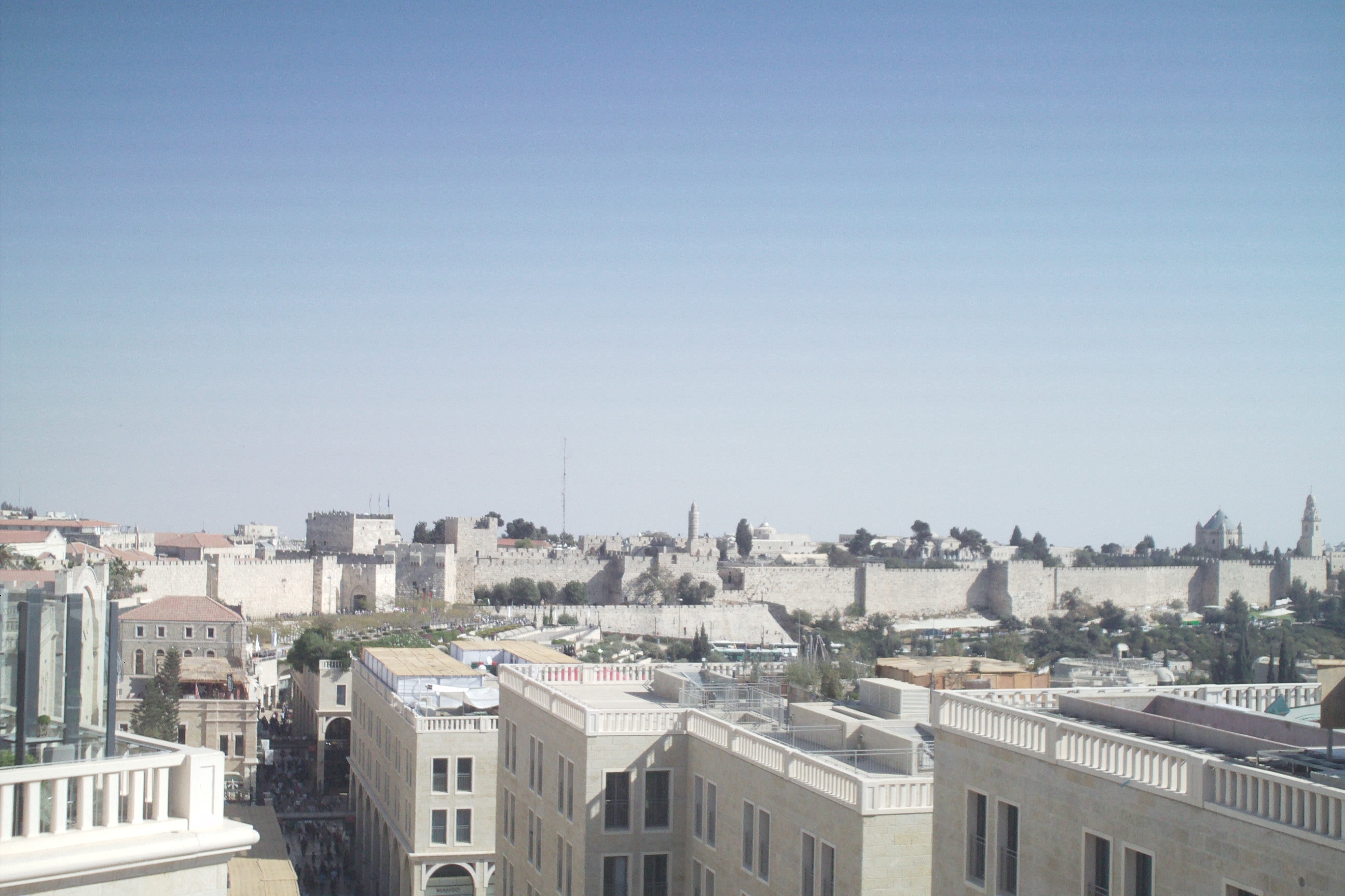
A few bridges for pedestrians in Israel into old City of Jerusalem. Those were not a problem cause many had stone. Went from Mamilla Mall to Jaffa Gate. Polished stones in old city were very hard to walk on. I had a cane.


Lots of bridges going 95 to Stamford, Mystic, and Norwalk. In 1983, my fears about bridges manmade were confirmed. A 100 ft section on Interstate 95 bridge crossing Mianus River in Greenwich, CT, collapsed. I recently crossed this bridge and every time I do, I remember this collapse.

What I Learned From Using Social Media
Posted on March 30, 2023 by sandraharrison1954
Leave a Comment
Social Media platforms are very different. Actually, find Twitter easier to use than Facebook (FB) but it is more restrictive with the characters allowed.
Often on Face Book (FB) people who post pictures of themselves do so to brag about something they have done or are doing and most just want positive only responses or even “nonpolitical” ones. And if one posts something negative or just contrary, the “Friend” gets offended. They could have just removed, blocked or hidden a response but instead the poster comes back with defensive comments like “if you didn’t have anything nice to say, then just don’t say.” “But that argument is hypocritical cause the person is actually attacking you personally doing what they don’t like being done to them. This is just attacking you personally in an effort to discourage negativity.
One woman in a “Creative Gardening Group” didn’t like my response stating that I disliked a picture of a piano filled with flowers put under a window that was right up against her house. I stated that the wood and keyboard were rotting. Also found that using pianos to do flower and plant displays in outdoor gardens is not an original idea after doing a search online. But the poster and others in the groups started attacking me personally telling me that “I was not nice,” and that “I must not have happiness in my life.”
Another instance was with a group “White Plains Citizens to be Heard” poster that said I was just complaining and that I was “noise.” This was a person trying to get people to be part of a city meeting to develop a comprehensive plan for the city. But if he wants people to come together as a group to shape a comprehensive plan, then my comments should be heard as well. I had voiced a comment that my city of White Plains (WP) sometimes solicits community input but rarely implements them into the actual final plans. Our community has real problems with empty buildings and neighborhoods that have become blighted, a term used by a former Mayor to justify the developers’ plans to eliminate blight by building more apartments higher and higher and eliminating more and more green space. To my, the blight is caused by property owners who stop maintaining their properties, so they decline and decay. These same buildings were once shiny and new construction. But if I am just doing complaining what is everyone else doing?
If we are all “noise” then why bother with a group called “White Plains Citizens to be Heard?” Or to get the community involved in any future planning. Neighbors in my building and people I have spoken to in my community do not believe our city cares what we think and just approves all developments.
Then there are those who just defriend you and block you from being their friend on Facebook when they don’t want to hear a different and opposing opinion. They could just not follow you and hide your comments but no they go and defriend you. This for me has included a relative in Texas who posted a picture of Donald T but didn’t want any political comments posted. I was using FB to engage with my actual friends and/or family for important things. I now have to email her since she does not see my posts about my parents that she might want to know what is happening to them.
Then there was another including a City Council woman who didn’t like my statement that the Hospital’s newest tall structure should have included parking instead of depending on city’s parking garage that was intended for the whole neighborhood. Hospital doesn’t pay taxes or to maintain the garage. But, then the same Councilwoman posts on “White Plains Citizens to be Heard “established for citizens to make comments good or bad about the city. She has her own agenda in wanting developers to hire contractors’ owned by Black businesses. Many developers in my city use non-union workers and do not chose black owned contractors. Many in community also want union workers hired because they get higher wages and demand better working conditions along with better benefits. I agree with her on this but if I comment on her postings, how will she react?
I though accept and read a lot of negative comments on my FB page and often start a dialog with them. Find this this challenging and sometimes are surprised that “friends” are on other pages or groups that I follow. It turns out to be a “small world after all.” Of course, I was naïve to think that everyone is allowed to be honest on FB when many out there are just looking for a pat on the back with glowing complements. So Is FB just an Ego platform? Even businesses can get negative comments and we have the right by law to post them as long as the basis for the comments is truthful.
Then there are the people who are trying to be “friends” with you for other things than just on FB. Have trouble with men and foreigners who post comments that I know will most likely will be scamming me for something or to get my info. I stopped listing things in my profile. I had email account stolen from me in Oct 2020 and a cousin got scammed by the person. I really liked my email address and because I didn’t couldn’t change all my accounts or places where I listed it (like on Ebay), this scammer could still be looking to hack me and steal something.
When using FB, posts that are personal are more appealing than those posts just passing on statements that come from somewhere else. People do not like to read long statements and one has to be as brief as possible. But if you do make a long statement, try giving a brief summary at the beginning before going into all those details.
Another thing I learned is that one can use social media to manipulate people. FB is a great marketing tool better than with and ad that one has to pay extra for. One can lure others to your FB page by posting on other pages or in other groups by putting in a link to your website. I use FB to draw people to my website sandraharrison1954.com and it often works. I am though not making any money from this, but I get more traffic.
People often post pictures but without identifying the people in the pictures. They seem to either not think it is important or that everyone knows who the people are.
So, what have you learned?
Share this: Sandy's Written Creations