Sandy's Written Creations
Writings by Sandra Harrison including poetry, essays, fiction, non-fiction; children's literatire.
Bryant-Mamaroneck Park Revisit

City put in trail, bird feeders and storybook program in the former Bloomingdale Hospital property. A bridge goes over Causeway or Castaway stream.


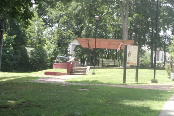
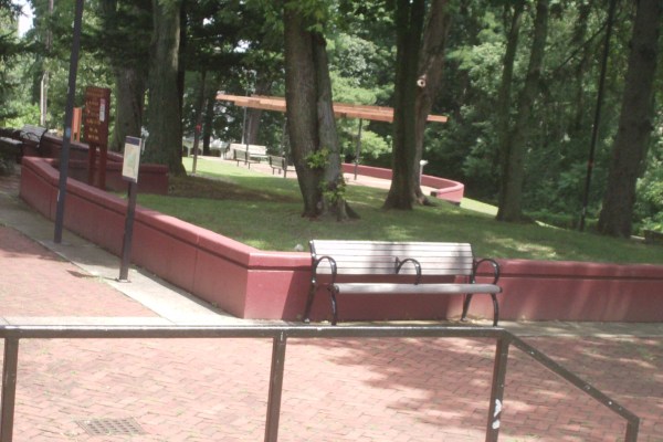
Battle of White Plains Park Revisited

When revising book about White Plains, one of the things that changed since its publication in 2013 is the renaming of the park at Battle and Whitney Avenues. The site is the American’s hold on Chatterton Hill during American Revolution in the Fall of 1776. But, the really change to the park has been the sign (from 2016 visit):


")
")

Another thing to add is about the park’s location. During the Battle, the hill was known as Chatterton and was named for the only tenant farmer Michael Chatterton. The Chatterton house was at the bottom of hillside on what is now Tarrytown Road (close to Bronx River). The hill was part if a much larger land tract that the Frederick Philipse Family had acquired. Frederick Philipse I had sought refuge from Catholic persecution in Bohemia to the Netherlands decided to emigrate to NY. In 1682, he purchased land in Westchester (his home is still located in Yonkers) but over time the family’s land ownership expanded North and northwest along the Hudson. Their land included Chatterton Hill. The family during the revolution sided with the British and after the war, the land was confiscated. Chatterton Hill was part of Greenburgh.
John Lester owned a large area on the top of the hill. Lester was a Bank Director and in 1867 had a large home built. The City of White Plains annexed Battle Hill in 1916 but the home was later demolished in 1960’s. This is now the locale of the park. With the coming of the railroad and by 1905, the hill was promoted for sale by developers who put in the streets and utilities. Vivian Heights was in the west side by Central Ave. Washington Heights Park was near what is now Tarrytown Rd near County Center. Battle Hill Oark was on the south side by Chatterton Parkway where lots sold for $800 and homes went for $4,000.
")
")

Bedford, NY Visit
Here are some of the photographs from my trip to Bedford by way of old Post Road that is Rte 22 now.
")
")
")
")
")
")
")
")
")
")
")

")
")


")

")
")
")
")

")
")


")
")
")
")
")
")
Hamilton Avenue

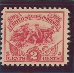 Alexander Hamilton has been getting a lot of attention these days due to the success of the play “Hamilton,” but Hamilton has always been a part of White Plains’ historic past.
Not only were streets named after him (Alexander & Hamilton Ave) but his likeness was used on 1926 mural and stamp created by Edmond F Ward to celebrate the nation’s birthday. The mural was originally made for the Grand Street Post Office but was given to City after post office closed. It now hangs in the White Plains Public Library.
During the Battle of White Plains, the young Hamilton of the New York Artillery Company was stationed on Chatterton Hill. He commanded one of two cannons stationed on the hill now known as Battle Hill.
Alexander’s image is on every US $10 bill and is one of New York’s most famous citizens. Hamilton died in 1804 at age 49 from the wound he received during his duel with Aaron Burr.
Recently, a descendant of Hamilton visited White Plains.
Seeking History One Foot At A Time: White Plains’ Walking tours


At Colonial Day June 18, 2016 in Tibbits Park, City Clerk’s Office gave out two walking tours to explore the past:


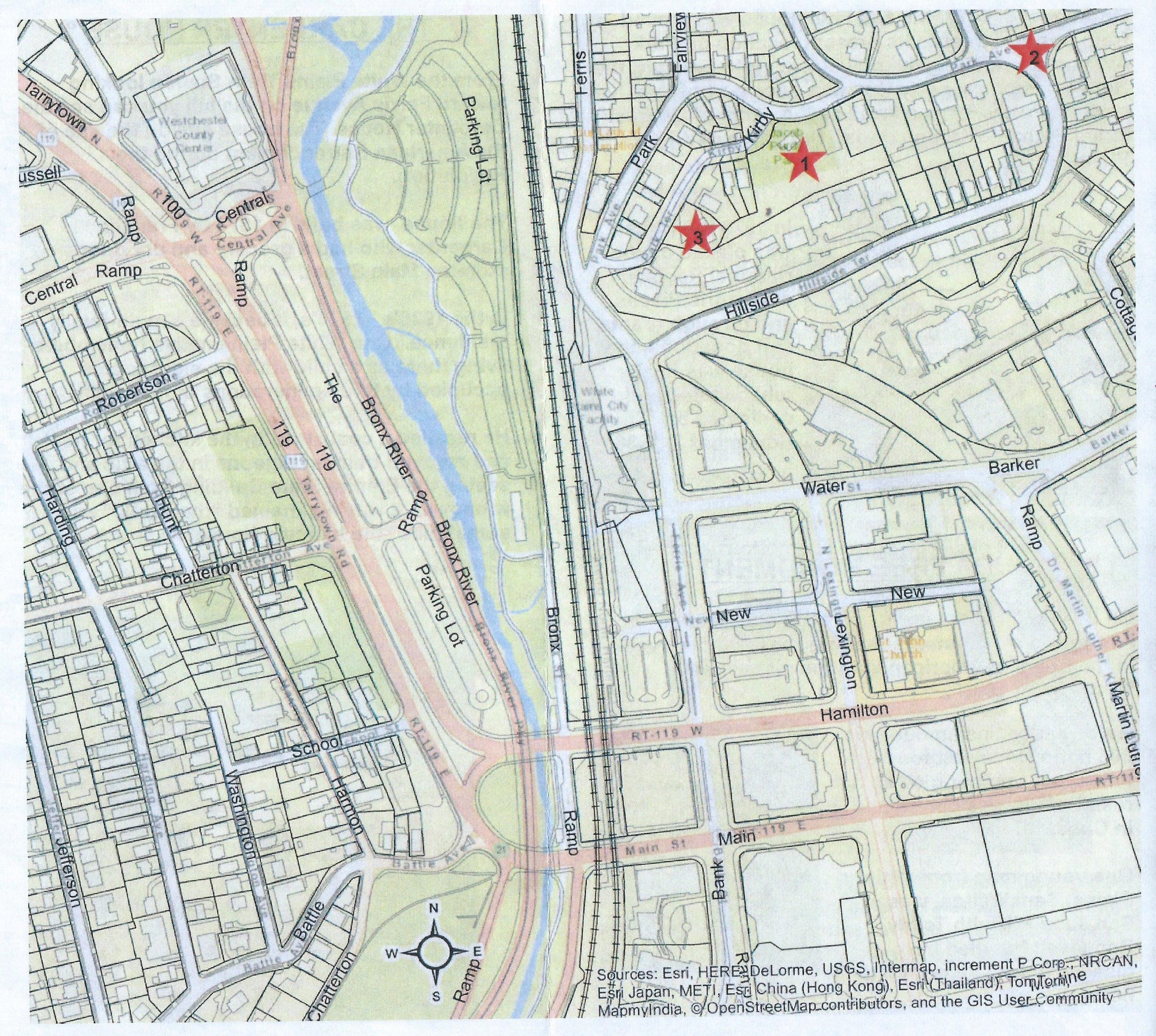
My walking tour from a number of years ago. Park at NWP (free on weekends) and walk South to Parkway walking path, go under tracks at tunnel, head East to N Broadway looking for Heritage trail markers, go into WP Royal Cemetery, then go back to road, go down Westview to see Miller Home (blue by 287, go back to N Broadway, stop at church, on to Tibbits, on to Armory on Mitchell, see Mitchell House on Mitchell Pl, go back to Westchester Mall going in or around to Hospital on Bloomingdale. Go back on Westchester Ave to N Broadway to Good Council, and back to car. :

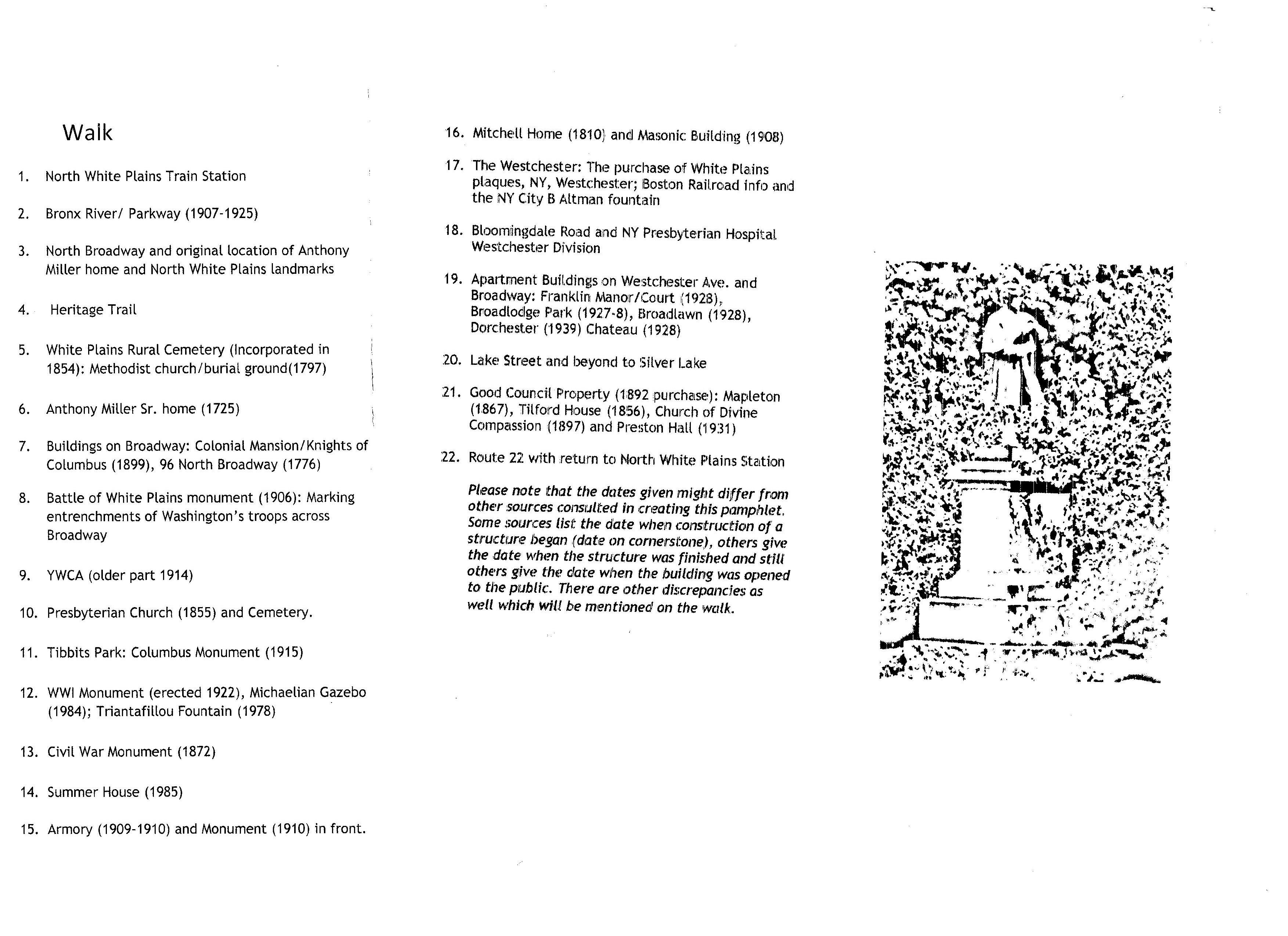
Heritage Trail is available through White Plains Historic Society and for Washington Rochambeau Revolutionary Trail a National Park Trail has its own website. Markers are in WP are in Tibbits Park. More info can be found in other entries of this website.
“Gilbert Cannan and His Mill” by Mark Gertler

Saw “Finding Netherlands” musical on Broadway and there was a scene with a merry go round and all I could think was that’s Mark Gertler’s painting. Women had hats with the flat tops just like in painting. There are videos you might access for “Circus of Your Mind” from play.
J.M. Barrie (the character in “Finding Netherlands” that the play is based on is related to Mark Gertler by way of Gilbert Cannan. Porthos, Barrie’s dog, is portrayed in the painting of Gilbert Cannan and his Mill. Cannan and Barrie were acquainted.
The song number of “Circus of Your Mind” had a part that was just like the “Merry Go Round” painting of Gertler where actors used poles surrounding Barrie in the play.
My reference in my play of going “round and round” I found in article I found online:
My Daily Art Display today is all about the artist and the person who is the subject of the painting. The artist who painted today’s featured painting was Mark Gertler and the painting which he co…
Where is the Mamaroneck River in White Plains?

Came across this article from New York Times August 14, 1988: “Wanted: A Watchman Of the Waterways” written by William G. Lawyer who at the time was the executive director of the Greenburgh Nature Center. Keep in mind that it was written long before the extensive flooding of Hurricane Irene in 2011. It is hard to find information about the River and other sources do not refer to the east branch as the section that is north-east of Saxon Woods but rather a branch that is further Northeast going into Purchase.
WHEN the first European settlers arrived in lower Westchester in the 17th century, they had to have been impressed with the opportunities they found. Among the region’s hills and valleys was a network of waterways that could provide bountiful hunting grounds for fur-bearing animals, and countless sources of water power to develop the agricultural and lumbering needs of the European colonial economies.
To be sure, none of the interior waterways of lower Westchester matched the mighty Hudson in terms of its breadth and volume. And calling such tributaries as the Saw Mill, Bronx, Hutchinson and Mamaroneck rivers was really stretching a point – where I grew up in southern Pennsylvania we called bodies of water much larger than the Bronx River creeks.
Nevertheless, Westchester’s bodies of water were quickly put to use for mills, reservoirs and waste disposal. The waterways provided the template for the patterns of human development up through the early 20th century. Roads and development followed streambeds geography.
As I traverse the roadways of lower Westchester in the 1980’s, however, I feel that the days when waterways were treasured are over. Now they are more likely to be seen as nuisances to be hidden away, to make room for more highways, more housing and more office-park projects.
A look at the Mamaroneck River – Westchester’s largest watershed system emptying into Long Island Sound – provides a good example of how early development was dependent upon the coexistence with the watershed. And how we are now in the process of ”disappearing” it.
The Mamaroneck River’s numerous branches drain an area of more than 21 square miles, from upper New Rochelle and northern Purchase to the Sound at Mamaroneck Harbor. Its main tributaries are the Sheldrake River, and the East and West Branches of the Mamaroneck, which join together at Saxon Woods.
The Sheldrake begins in the highlands by the Scarsdale-White Plains border, where Garden Road becomes Hartsdale Avenue. From there it flows south through the Fenway Golf Club, by Scarsdale Junior High School, Heathcote, Carpenter Pond, the Hutchinson Parkway, Pine Brook Boulevard, Sheldrake Lake, Weaver Street, I-95, Washingtonville, then joins with the main branch in Columbus Park by the train station.
The West Branch begins near Ridgeway, by Seeger Drive, then flows along Saxon Woods Road until it meets the East Branch. The latter has several smaller tributaries, originating at the Westchester Hills Country Club, Manhattanville College, the Century Country Club and the highlands between the White Plains Reservoir and Rye Lake. The main section is from Silver Lake, along I-287 to the Hutchinson Parkway, through the Maple Moor Golf Course, then along the ”Hutch” to where it joins the West Branch.
In earlier times at least 12 mills were established along the river’s course – starting with one just a few hundred yards in from the harbor that was powered by the changing tides. Carpenter Pond on the Sheldrake, in New Rochelle, and Silver Lake, on the East Branch in White Plains/Harrison, were two of the most prominent mill sites and lasted until late in the 19th century.
Ponds were also created for fishing, ice-making and recreational purposes. Ten golf courses – from the Brae Burn to the Winged Foot – were developed in the 20th century, using portions of the watershed for their attractive obstacle-course system. The county’s Saxon Woods Park, and the campus sites of New York Hospital and Manhattanville College incorporated watershed streams as part of their landscape design.
Although it now seems hard to believe, in earlier times the Mamaroneck River was very important in providing water for drinking and commercial uses. Two reservoirs were constructed along the Shelldrake, and the Mamaroneck Reservoir was established along the main river near lower Saxon Woods.
Finally, the watershed provided an attractive setting for residential sites. From the elegant mansions of the 19th century in Purchase and White Plains to the charming, more modest homes near the Mamaroneck Reservoir, homeowners took advantage of the gently flowing stream to enhance the beauty of their property.
In the late 19th century it became apparent that the use of the Mamaroneck River for both drinking water and as a receptacle for sewage was inappropriate. So the sanitary sewage system was developed. Pollution problems continued, but at least the values of the water to human needs were being asserted.
By the mid-20th century, all these valuable uses of the Mamaroneck Now a watershed is likely to be seen as a nuisance. River basin were on the way out. Water power was a thing of the past, and only a few foundation stones remind us of the waterway’s mills. The river’s use as a source of drinking water was phased out, with the reservoir waterworks being converted to pumping stations for New York City’s Catskill water system.
Ponds were drained to provide more land for housing. Riverbeds had been squeezed into ever-smaller channels along the ever-widening roadways – the Hutchinson Parkway, the Cross Westchester Expressway and the New England Thruway.
Although the river was never navigable, at least in earlier times it was possible to walk along its main branches, enjoying the flora and fauna. Now one has to negotiate highways, culverts and storm sewers even to follow its course. Just finding it on a map can be difficult, because it goes underground in so many places to accommodate development.
I dare anyone to walk from Silver Lake to North Street along the river without suffering at least a moderate degree of stress from the high-speed automotive mayhem of I-287, I-684 and the ”Hutch.”
After leaving the parkland of Silver Lake and Delfino Park, the river has been relegated to the ”no man’s land” between interstate highways and Westchester Avenue eastbound. Instead of paths and scenic views, the riverbed is walled in by relocated rocks, cement channels and thick growths of the various species of hardy weed plants, shrubs and trees that have been able to adapt to such a hostile setting. Poison Ivy is, of course, plentiful, as is the debris of modern life.
As a result of all the upstream disruptions to the river’s ability to absorb rainfall, and uncontrolled development of the flood-plain areas, downstream flooding has caused extensive property damage. Now the Army Corps of Engineers is proposing a $60 million project to build an underground channel to take the Sheldrake directly to the Sound and to realign the main channel from Columbus Park to the harbor. Such a solution does nothing to help restore the river’s ecological value.
Of course, all has not yet been lost. The river still has more tranquil settings, such as when it flows through part of the Maple Moor golf course, along Saxon Woods Road and between the Mamaroneck Reservoir and I-95. And a major positive step was taken when the Larchmont Reservoir along the Sheldrake branch was set aside as a nature-study area. Some efforts were taken in the widening of the Hutch to restore the riverbed to a more natural format.
What worries me is that, in the planning process that determines whether roads are widened and office buildings or homes are built, no one seems to consider the importance of protecting the waterway’s integrity. By this I mean its integrity as a functioning part of the region’s ecosystem – providing for the needs of the wildlife. These include service as a spawning ground for fish, reptiles and amphibians; a source of food and shelter for all the other animals native to this area; and a resource to help provide for the human needs of food, water and recreation. How can we put a value on the impact that widening I-287 or the Hutch will have on the Mamaroneck River?
A good example of this is the current problem concerning ”Larchmont Gardens Lake,” a man-made pond on a Sheldrake branch of the river in the Town of Mamaroneck. When town officials went to dredge the pond, they learned that the sediments contained unsafe levels of hydrocarbons. Now it appears it will cost about $500,000 to transport the dredged materials to a site licensed for ”industrial waste.” The source of these? The State Department of Environmental Conservation said they probably came from nearby I-95. The pond is one of the watershed’s most scenic and accessible sites.
Several years ago, when we were suffering from the kind of drought conditions now widespread in the Middle West, we had to resort to drawing water from the Hudson – a reminder of the importance of our local resources.
Perhaps what is needed is the equivalent of the Hudson River’s Riverkeeper – a watchdog position supported by nonprofit interests. Maybe each interior river doesn’t warrant its own keeper, but at least there could be one to watch over the largest in lower Westchester – the Mamaroneck, Bronx, Saw Mill and Hutchinson. No one is regularly monitoring water quality, herbicide and pesticide runoff or illegal dumping. Just recently there have been several incidents of large fish kills, attributed to low oxygen levels.
While the government ”studies” the problems of the Sound and its tributaries, development and streambed degradation continue apace. We teach our children about nature and ecology, but we don’t apply these concepts to the very things that are going on right in our backyards. How can we save the earth if we lose the Mamaroneck River?
What I can determine about the Mamaroneck River from the few sources I have found is that its watershed covers over 17 sq. miles. In White Plains, it covers most of the City. It covers the eastern side in the north but all of the southern half. The Bronx River has a smaller watershed and this is in the northwest part but the watersheds overlap. The two watersheds overlap.
The river begins in wetlands north of Silver Lake in West Harrison. The river was dammed to create the lake known today as Silver Lake around 1721. As the river goes south much of the water is in underground pipes. There are some tributaries that branch off and into the river. An eastern branch comes into river from areas in Purchase. The river also served as a boundary between West Harrison and Purchase. The Expressway Cross Westchester 287 goes along the river boundary area. A stream comes into river at Maple Moor Golf Course and water comes down into the area north from Gedney Farms Neighborhood where two golf courses were created. One golf course north of Ridgeway was purchased and the owners want to develop land into a school. The opposition to the school from the City and community has put the project in limbo for over five years.
The West Branch starts in wetlands behind Archbishop Stepinac High School extends down through neighborhoods south above and below ground into Saxon Woods as it meets the main part of the river. This tributary served as a boundary line in 1721 Royal Patent. The river is northeast of Mamaroneck and and can be viewed above ground at different
Presidents in White Plains

Presidents are honored in White Plains (WP) by the naming many of its streets after them.
Besides the street named for him, our first President had a school named for him. There is a George Street but there are others that this street was named after. Developers often gave names to streets with the approval of the City.
Some of the streets named after our Presidents are Washington, Jefferson, Jackson, Lincoln, Grant, McKinley, Harding and Coolidge Avenues, Fillmore Place and Cleveland St.
City has a Clinton Drive and Street but this naming came long before President Bill Clinton was in office.
Some Presidents have come to WP and many Presidental candidates have n included a stop in WP.
Martine Ave of White Plains


The Martine Family had a large homestead that was in the area between what is now East Post Road and Martine Avenue across from the Coachman on East Post Rd.
William Martine (b.1796) is listed in the 1880 census as still living in White Plains at age 84 as a widow. He was married to Fanny Van Wart (1793-1824) who was a descendant of the Isaac Van Wart family. Isaac Van Wart was one of the captors of Major Andre.
Stephen A. Marine in 1868 donated land for creation of the street that still bares his name. Stephen died in 1871. His widow remarried but died 6 years later (aged 39) from food poisoning in anti fat medicine. The home was then used by the Keeley Institute from about 1871 to about 1900 till it moved to a bigger building on Maple. Keeley Institute was established to help Alcoholics.

The Family Homestead was moved to its present location at 149 Grand Avenue during the early 1900’s. Today the building is a commercial building for various businesses. Below is from Weichert Rental Network’s website:


Art in White Plains
Posted on July 22, 2016 by sandraharrison1954
Leave a Comment
Walking around city, one can find art in and outside buildings, in parks and on sidewalks.
Share this: Sandy's Written Creations