Sandy's Written Creations
Writings by Sandra Harrison including poetry, essays, fiction, non-fiction; children's literatire.
Waterways in White Plains
Entry is an updated version of the section on “Waterways” in the book: White Plains, New York: A City of Contrasts:
Entry is an updated version of the section on “Waterways” from the book: White Plains, New York: A City of Contrasts:
WATERWAYS: Many of the city’s former wetlands, ponds and streams are gone. The Bronx River (pictured) in the northwest White Plains (WP), the Mamaroneck River & its tributaries (including the West Branch) were used as boundaries for the Village of WP in its patent request.
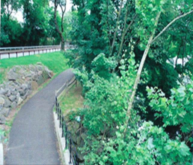
The Bronx River was named after Westchester’s first European settler Jonas Bronck. The river still runs above ground in the northwestern part of the city and can be explored along a multipurpose paved path. Efforts were made in recent years to bring back some of the wetlands and native plants along the river bank to reduce flooding.
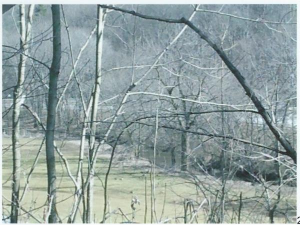
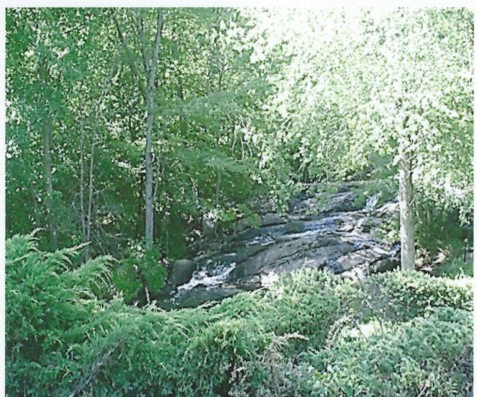
The Mamaroneck River & its tributaries still run in sections of the city, but many parts are below ground in pipes (covert). The river’s watershed covers most of WP. “Lighted” or visible sections can be found at Maple Moor Golf course (pictured), Saxon Woods Park, in the neighborhoods north from these areas, in the northeast part of WP by Delfino Park & Lake St. Ponds & small streams appear in other sections of the city connected to the river.
Cassaway or Causeway stream runs easterly along Bloomingdale Rd & Mamaroneck Ave from Burke Rehabilitation Hospital’s grounds to the grounds of the NY Presbyterian Hospital. Pictured below is the stream going under Bryant Ave as one can view at the park at the corner of Bryant and Mamaroneck where there are walking trails. Other parts of the stream can be seen in the park.

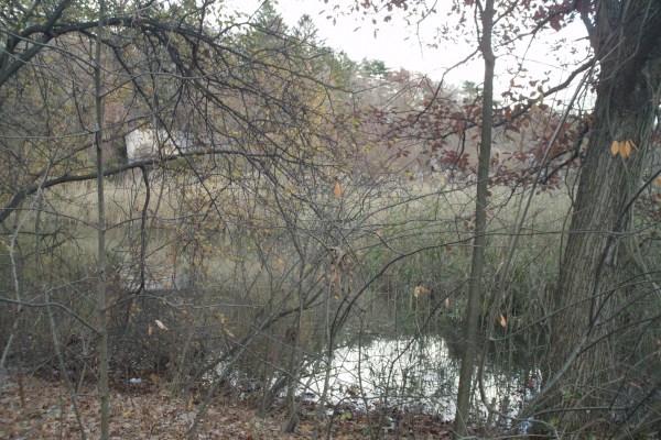
The stream opens at Bloomingdale Pond (pictured below) which is west of the NY Presbyterian Hospital entrance. The pond was a water source for the hospital when it was Bloomingdale Asylum. As to whether the stream still runs underground east to the Mamaroneck River as it once did could not be determined because of the roadways. Old maps show a branch of the stream that crossed Mamaroneck Ave across from Burke.
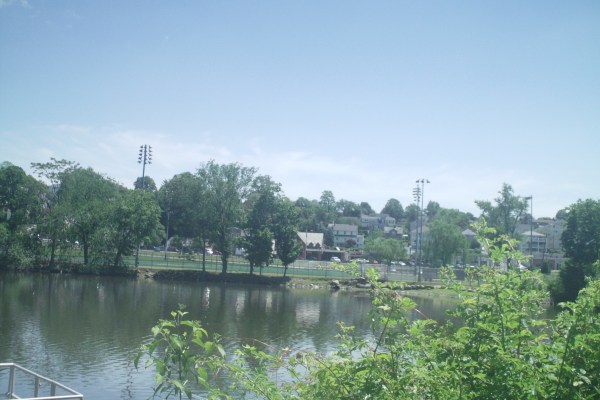
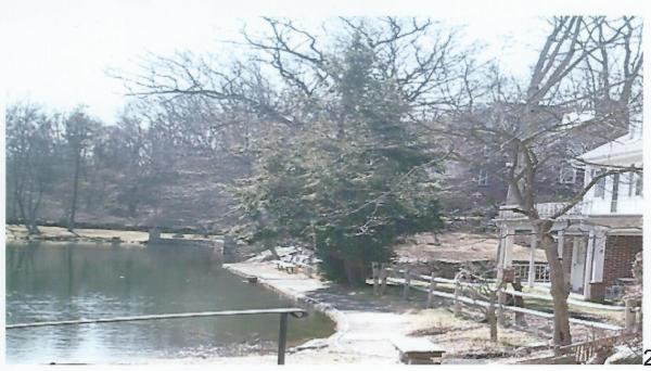
Silver Lake (pictured below from the White Plains side looking toward West Harrison) along the city’s northeast border with West Harrison was known as Horton’s Pond during the Battle of WP & was where General Washington stored munitions. The manmade lake dates from 1726; was used by a mill at its southern end and later by an ice company.
The stone section of the home at 147 Lake St is what remains of a Mill that according to Renoda Hoffman was damaged by fire in the 1800’s. (People claim the mill was Horton’s Mill).
In WP, the lake (that has had numerous names) can be accessed from Liberty Park on Lake St. or from the West Harrison Park in West Harrison. Another way in is through the County’s Silver Lake Preserve on Merritt Hill where there is a parking area above the lake. There are a number of walking trails in the Preserve and one that goes from Liberty Park into the Preserve (video below was taken on trail).
Todd Pond in the Westminster Park residential area of the city along Lakeside Ave and Garretson Rd gets its name from A. C. Todd who created Westminster Park in 1912. The lake is privately managed as a recreation area.
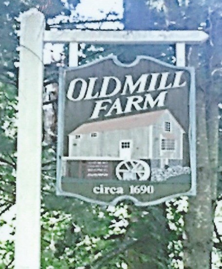
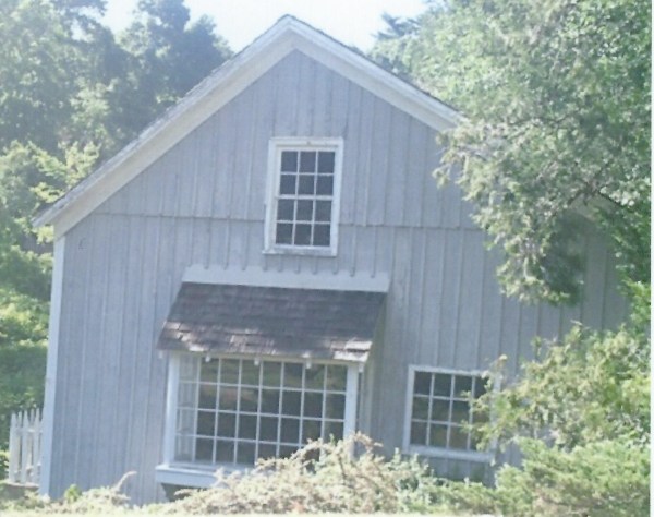
A mill dating from 1690 along the Mamaroneck River can be found in the Town of Harrison near the Hutchinson Parkway on Love Lane (pictured to right and below).
A number of streets in WP are named for its waterways such as Lake, Bank and Water Streets. White Plains like everywhere else is a watershed for the waterways. Rainwater goes into street storm drains and in White Plains this water either goes to the Bronx River or through to the Mamaroneck River. Water eventually travels to the Long Island Sound.

Hi Sandy. I recently discovered the trails around Silver Lake Preserve and have been giving them a hike. The easiest one just following the perimeter of the lake, but there were some very clear forks heading uphill that I wanted to explore. Your vid from this post encouraged me to check out some more difficult trails. I took some pictures and screenshots of my coordinates when I found something cool. Here’s a link to the gallery. https://imgur.com/a/7qDBVvB
I was able to find some old trail markers for a white trail, a blue and yellow, and it looks like someone had put orange hearts up as a trail marker too. I followed the orange hearts for most of my hike, but also had somewhat of a map to guide me. The trails aren’t visible on Google maps, but OpenSourceMaps has them available. I have a screenshot of that attached to the end of the gallery.
Do you have any information about these old stone walls and stone structures?
I also want to try to find Pop’s Cave next time I go, but I haven’t found any coordinates for it. There’s a sign pointing towards its location, but I must have overshot it. I came across some info that it might have been an old Leatherman camping spot.
LikeLiked by 1 person
Thanks responding, but it looks like your well written response was attached to one of the deleted glitch comments I posted. I can’t see it on your normal blog, just in my email.
I’ll give exploring another crack after a little more research and prep. I’ll see if I can start at the cemetery and make my way down to Pop’s Cave. Thanks!
LikeLike